

Dach der Tour
A cycling route starting in Ossiach, Carinthia, Austria.
Overview
About this route
Once again, we go over the pass - Hochrindl at 1,606 meters is the roof of the tour. A spectacular descent with up to 16% gradient in places - good brakes are required here. Afterwards, we ride through the most beautiful landscape along the Gurk. In Fuchsgruben, you emerge from the forest and enjoy a lovely view of the Carinthian lowlands. Continuing over Steuerberg and St. Ulrich to the ascent to Buggl in Bach.
- -:--
- Duration
- 78 km
- Distance
- 1,736 m
- Ascent
- 1,179 m
- Descent
- ---
- Avg. speed
- ---
- Max. altitude

Continue with Bikemap
Use, edit, or download this cycling route
You would like to ride Dach der Tour or customize it for your own trip? Here is what you can do with this Bikemap route:
Free features
- Save this route as favorite or in collections
- Copy & plan your own version of this route
- Sync your route with Garmin or Wahoo
Premium features
Free trial for 3 days, or one-time payment. More about Bikemap Premium.
- Navigate this route on iOS & Android
- Export a GPX / KML file of this route
- Create your custom printout (try it for free)
- Download this route for offline navigation
Discover more Premium features.
Get Bikemap PremiumFrom our community
Other popular routes starting in Ossiach
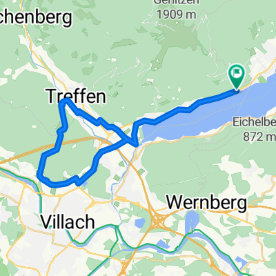
 Runde um Ossiacher See
- Distance
- 25.4 km
- Ascent
- 136 m
- Descent
- 147 m
- Location
- Ossiach, Carinthia, Austria
 Lindenweg nach Tiebel
- Distance
- 28.1 km
- Ascent
- 644 m
- Descent
- 331 m
- Location
- Ossiach, Carinthia, Austria
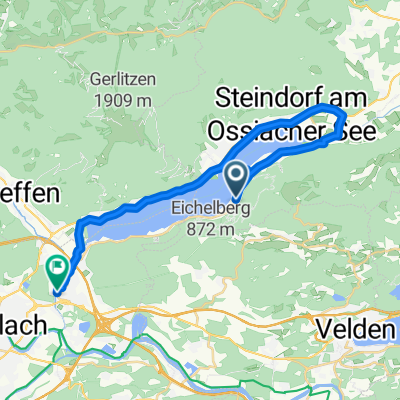
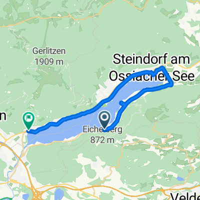
 Steindorf am Ossiacher See - Pontebba (2/2)
- Distance
- 58.5 km
- Ascent
- 969 m
- Descent
- 763 m
- Location
- Ossiach, Carinthia, Austria
 Köstenberger Dorfweg nach Altossiach Dammweg
- Distance
- 9.2 km
- Ascent
- 155 m
- Descent
- 409 m
- Location
- Ossiach, Carinthia, Austria
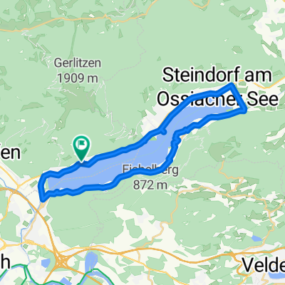
 Route in Treffen am Ossiacher See
- Distance
- 33.5 km
- Ascent
- 653 m
- Descent
- 650 m
- Location
- Ossiach, Carinthia, Austria
 Ostriach, Ossiach - Ossiacher See Straße, Treffen am Ossiacher See
- Distance
- 20 km
- Ascent
- 176 m
- Descent
- 168 m
- Location
- Ossiach, Carinthia, Austria
 Dorfstraße, Treffen am Ossiacher See to Dorfstraße, Treffen am Ossiacher See
- Distance
- 29.7 km
- Ascent
- 393 m
- Descent
- 402 m
- Location
- Ossiach, Carinthia, Austria
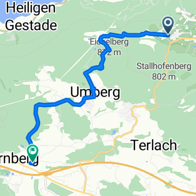 Leitnweg nach Trabeniger Straße
- Distance
- 8.1 km
- Ascent
- 110 m
- Descent
- 419 m
- Location
- Ossiach, Carinthia, Austria
Open it in the app