

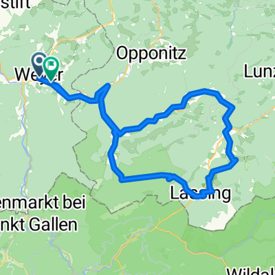
Weyer-Waidhofen/Y.-Opponitz-Walcherbauer-Weyer
A cycling route starting in Weyer, Upper Austria, Austria.
Overview
About this route
- -:--
- Duration
- 51 km
- Distance
- 640 m
- Ascent
- 641 m
- Descent
- ---
- Avg. speed
- 557 m
- Max. altitude

Route quality
Waytypes & surfaces along the route
Waytypes
Cycleway
21.9 km
(43 %)
Quiet road
9.2 km
(18 %)
Surfaces
Paved
40.3 km
(79 %)
Asphalt
40.3 km
(79 %)
Undefined
10.7 km
(21 %)
Continue with Bikemap
Use, edit, or download this cycling route
You would like to ride Weyer-Waidhofen/Y.-Opponitz-Walcherbauer-Weyer or customize it for your own trip? Here is what you can do with this Bikemap route:
Free features
- Save this route as favorite or in collections
- Copy & plan your own version of this route
- Sync your route with Garmin or Wahoo
Premium features
Free trial for 3 days, or one-time payment. More about Bikemap Premium.
- Navigate this route on iOS & Android
- Export a GPX / KML file of this route
- Create your custom printout (try it for free)
- Download this route for offline navigation
Discover more Premium features.
Get Bikemap PremiumFrom our community
Other popular routes starting in Weyer
 OÖ Rundfahrt Etappe 1 (Weyer-Steinbach/Attersee))
- Distance
- 139.8 km
- Ascent
- 1,419 m
- Descent
- 1,371 m
- Location
- Weyer, Upper Austria, Austria
 Marktplatz nach Hollensteiner Straße
- Distance
- 79 km
- Ascent
- 2,156 m
- Descent
- 2,126 m
- Location
- Weyer, Upper Austria, Austria
 Weyer-Altenmarkrt-Hengstpass und zurück
- Distance
- 80.3 km
- Ascent
- 2,196 m
- Descent
- 2,196 m
- Location
- Weyer, Upper Austria, Austria
 Kombitour 1 & 12
- Distance
- 38.7 km
- Ascent
- 1,021 m
- Descent
- 1,016 m
- Location
- Weyer, Upper Austria, Austria
 Powerman Weyer
- Distance
- 41 km
- Ascent
- 551 m
- Descent
- 546 m
- Location
- Weyer, Upper Austria, Austria
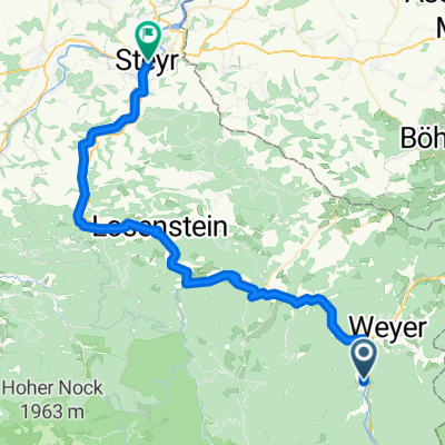 3. Kleinreifling-Steyr
- Distance
- 51.9 km
- Ascent
- 1,802 m
- Descent
- 1,913 m
- Location
- Weyer, Upper Austria, Austria
 Weyer Hochkar
- Distance
- 42.1 km
- Ascent
- 1,690 m
- Descent
- 349 m
- Location
- Weyer, Upper Austria, Austria
 Weyer Panoramaroute
- Distance
- 26 km
- Ascent
- 808 m
- Descent
- 807 m
- Location
- Weyer, Upper Austria, Austria
Open it in the app