Tura Tara Calatei - onroad-ish
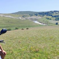
A cycling route starting in Aghireșu, Cluj County, Romania.
Overview
About this route
- -:--
- Duration
- 35.4 km
- Distance
- 714 m
- Ascent
- 641 m
- Descent
- ---
- Avg. speed
- 737 m
- Max. altitude
Route quality
Waytypes & surfaces along the route
Waytypes
Track
12.4 km
(35 %)
Road
8.1 km
(23 %)
Surfaces
Paved
15.9 km
(45 %)
Unpaved
4.6 km
(13 %)
Asphalt
15.9 km
(45 %)
Gravel
4.6 km
(13 %)
Undefined
14.8 km
(42 %)
Route highlights
Points of interest along the route
Point of interest after 1 km
Castelul Bocskai
Point of interest after 5.9 km
Gipsurile de la Leghia
Point of interest after 22.1 km
Dealul Riseg
Point of interest after 25.1 km
Platoul de arbori de la Jebucu
Point of interest after 34.5 km
Cetatea Corbului
Continue with Bikemap
Use, edit, or download this cycling route
You would like to ride Tura Tara Calatei - onroad-ish or customize it for your own trip? Here is what you can do with this Bikemap route:
Free features
- Save this route as favorite or in collections
- Copy & plan your own version of this route
- Sync your route with Garmin or Wahoo
Premium features
Free trial for 3 days, or one-time payment. More about Bikemap Premium.
- Navigate this route on iOS & Android
- Export a GPX / KML file of this route
- Create your custom printout (try it for free)
- Download this route for offline navigation
Discover more Premium features.
Get Bikemap PremiumFrom our community
Other popular routes starting in Aghireșu
- Tura Tara Calatei - onroad-ish
- Distance
- 35.4 km
- Ascent
- 714 m
- Descent
- 641 m
- Location
- Aghireșu, Cluj County, Romania
- KĂłs Károly KerĂ©kpáros EmlĂ©k- Ă©s TeljesĂtmĂ©nytĂşra
- Distance
- 60.7 km
- Ascent
- 395 m
- Descent
- 540 m
- Location
- Aghireșu, Cluj County, Romania
- Tura Tara Calatei - offroad
- Distance
- 28.8 km
- Ascent
- 677 m
- Descent
- 603 m
- Location
- Aghireșu, Cluj County, Romania
- DJ108C 211, Leghia - DJ108C 207, Leghia
- Distance
- 62.3 km
- Ascent
- 1,528 m
- Descent
- 1,533 m
- Location
- Aghireșu, Cluj County, Romania
- Aghires - Cluj
- Distance
- 55.8 km
- Ascent
- 265 m
- Descent
- 394 m
- Location
- Aghireșu, Cluj County, Romania
- KĂłs K16_2021
- Distance
- 16.1 km
- Ascent
- 394 m
- Descent
- 502 m
- Location
- Aghireșu, Cluj County, Romania
- Aghiresu - Bedechiu - valea Capusului - Cluj
- Distance
- 61.4 km
- Ascent
- 415 m
- Descent
- 528 m
- Location
- Aghireșu, Cluj County, Romania
- DJ108C 207, Leghia - QGXG+2V, Baciu
- Distance
- 39 km
- Ascent
- 813 m
- Descent
- 844 m
- Location
- Aghireșu, Cluj County, Romania
Open it in the app