

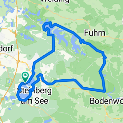
sportplatzstrasse 10 Steinberg am See über Regen Nittenau und Bodewöhr und zurück
A cycling route starting in Steinberg, Bavaria, Germany.
Overview
About this route
- 4 h 34 min
- Duration
- 43.5 km
- Distance
- 455 m
- Ascent
- 454 m
- Descent
- 9.5 km/h
- Avg. speed
- 471 m
- Max. altitude

Route photos


Route quality
Waytypes & surfaces along the route
Waytypes
Track
19.6 km
(45 %)
Quiet road
13.5 km
(31 %)
Surfaces
Paved
20.4 km
(47 %)
Unpaved
17 km
(39 %)
Asphalt
17.8 km
(41 %)
Gravel
13.5 km
(31 %)
Continue with Bikemap
Use, edit, or download this cycling route
You would like to ride sportplatzstrasse 10 Steinberg am See über Regen Nittenau und Bodewöhr und zurück or customize it for your own trip? Here is what you can do with this Bikemap route:
Free features
- Save this route as favorite or in collections
- Copy & plan your own version of this route
- Sync your route with Garmin or Wahoo
Premium features
Free trial for 3 days, or one-time payment. More about Bikemap Premium.
- Navigate this route on iOS & Android
- Export a GPX / KML file of this route
- Create your custom printout (try it for free)
- Download this route for offline navigation
Discover more Premium features.
Get Bikemap PremiumFrom our community
Other popular routes starting in Steinberg
 Route in Steinberg am See
- Distance
- 41.8 km
- Ascent
- 337 m
- Descent
- 328 m
- Location
- Steinberg, Bavaria, Germany
 sportplatzstrasse 10 Steinberg am See über Regen Nittenau und Bodewöhr und zurück
- Distance
- 43.5 km
- Ascent
- 455 m
- Descent
- 454 m
- Location
- Steinberg, Bavaria, Germany
 Alternative Radstrecke Supersprintdistanz 2023
- Distance
- 12.8 km
- Ascent
- 47 m
- Descent
- 48 m
- Location
- Steinberg, Bavaria, Germany
 Triathlon Radstrecke OD
- Distance
- 39.3 km
- Ascent
- 241 m
- Descent
- 236 m
- Location
- Steinberg, Bavaria, Germany
 2 Seen rundweg steinberger See
- Distance
- 10.4 km
- Ascent
- 107 m
- Descent
- 108 m
- Location
- Steinberg, Bavaria, Germany
 Oberpfälzer Seenland Triathlon - OST 2011 - Mittel- und Kurzdistanz
- Distance
- 35.7 km
- Ascent
- 257 m
- Descent
- 256 m
- Location
- Steinberg, Bavaria, Germany
 Am Kirchsteig 19, Wackersdorf nach Am Eisenhammer 3, Schwarzach bei Nabburg
- Distance
- 20.1 km
- Ascent
- 662 m
- Descent
- 719 m
- Location
- Steinberg, Bavaria, Germany
 Steinberger See
- Distance
- 42.7 km
- Ascent
- 286 m
- Descent
- 285 m
- Location
- Steinberg, Bavaria, Germany
Open it in the app