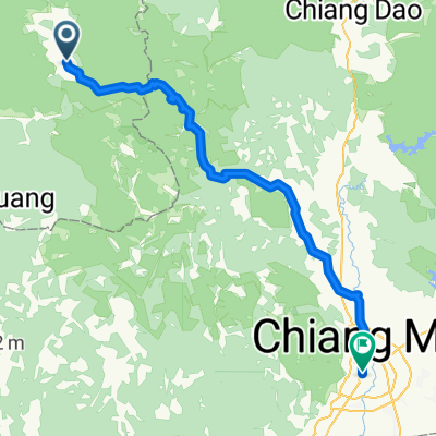
MueangPaeng_HueiPooLoei_WatChan
A cycling route starting in Mae Hi, Mae Hong Son, Thailand.
Overview
About this route
-
Teil der Strecke einfache Strassen und Feldwege teilweise dem Pai-River entlang.
-
Teil relativ breite Tracks in die Berge, einfach jedoch anstrengend.
-
Teil teilweise schmale Tracks auf 1600 MüM.
Boden oftmals feuchter Lehm, teilweise rote Staubpisten.
Fantastische Aussichten in den Bergen. Die Wege führen oftmals über Kammstrassen mit beidseitiger Sicht.
Bevölkerung: vorwiegend Hmongs und Akha.
- -:--
- Duration
- 171.1 km
- Distance
- 1,796 m
- Ascent
- 1,817 m
- Descent
- ---
- Avg. speed
- ---
- Max. altitude
Continue with Bikemap
Use, edit, or download this cycling route
You would like to ride MueangPaeng_HueiPooLoei_WatChan or customize it for your own trip? Here is what you can do with this Bikemap route:
Free features
- Save this route as favorite or in collections
- Copy & plan your own version of this route
- Split it into stages to create a multi-day tour
- Sync your route with Garmin or Wahoo
Premium features
Free trial for 3 days, or one-time payment. More about Bikemap Premium.
- Navigate this route on iOS & Android
- Export a GPX / KML file of this route
- Create your custom printout (try it for free)
- Download this route for offline navigation
Discover more Premium features.
Get Bikemap PremiumFrom our community
Other popular routes starting in Mae Hi
Mae Hi - Mae Taeng- Distance
- 59.2 km
- Ascent
- 135 m
- Descent
- 1,158 m
- Location
- Mae Hi, Mae Hong Son, Thailand
Pai - PoongSa - 1095- Distance
- 116 km
- Ascent
- 2,592 m
- Descent
- 2,982 m
- Location
- Mae Hi, Mae Hong Son, Thailand
Sakurawälder_1095_MueangKhong- Distance
- 116.2 km
- Ascent
- 3,559 m
- Descent
- 2,423 m
- Location
- Mae Hi, Mae Hong Son, Thailand
1095, Pai à Mae Na Toeng, Pai- Distance
- 12.4 km
- Ascent
- 554 m
- Descent
- 178 m
- Location
- Mae Hi, Mae Hong Son, Thailand
MueangPaeng_HueiPooLoei_WatChan- Distance
- 171.1 km
- Ascent
- 1,796 m
- Descent
- 1,817 m
- Location
- Mae Hi, Mae Hong Son, Thailand
Pai - Chiang Mai- Distance
- 125.4 km
- Ascent
- 1,237 m
- Descent
- 1,420 m
- Location
- Mae Hi, Mae Hong Son, Thailand
Pai_WatChan_SaoDaeng_NongKhaeow_MHS- Distance
- 193.7 km
- Ascent
- 2,629 m
- Descent
- 2,866 m
- Location
- Mae Hi, Mae Hong Son, Thailand
Pai - Chiang Dao- Distance
- 103.6 km
- Ascent
- 2,334 m
- Descent
- 2,410 m
- Location
- Mae Hi, Mae Hong Son, Thailand
Open it in the app

