

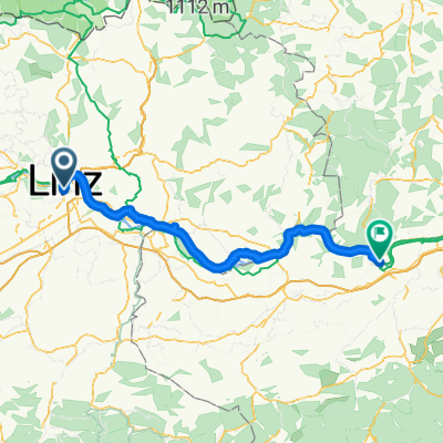
Kalkalpen-part1
A cycling route starting in Linz, Upper Austria, Austria.
Overview
About this route
- -:--
- Duration
- 127.1 km
- Distance
- 1,543 m
- Ascent
- 850 m
- Descent
- ---
- Avg. speed
- 959 m
- Max. altitude
Route quality
Waytypes & surfaces along the route
Waytypes
Quiet road
44.5 km
(35 %)
Cycleway
20.3 km
(16 %)
Surfaces
Paved
53.4 km
(42 %)
Unpaved
38.1 km
(30 %)
Asphalt
52.1 km
(41 %)
Gravel
16.5 km
(13 %)
Continue with Bikemap
Use, edit, or download this cycling route
You would like to ride Kalkalpen-part1 or customize it for your own trip? Here is what you can do with this Bikemap route:
Free features
- Save this route as favorite or in collections
- Copy & plan your own version of this route
- Split it into stages to create a multi-day tour
- Sync your route with Garmin or Wahoo
Premium features
Free trial for 3 days, or one-time payment. More about Bikemap Premium.
- Navigate this route on iOS & Android
- Export a GPX / KML file of this route
- Create your custom printout (try it for free)
- Download this route for offline navigation
Discover more Premium features.
Get Bikemap PremiumFrom our community
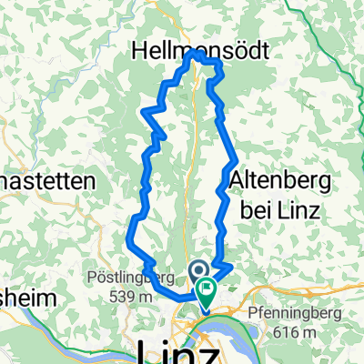
Other popular routes starting in Linz
 L-Pelmbergstüberl 03.10.25-L
- Distance
- 25.3 km
- Ascent
- 618 m
- Descent
- 618 m
- Location
- Linz, Upper Austria, Austria
 Trail GIS – Bachlberg Variante01
- Distance
- 21.7 km
- Ascent
- 713 m
- Descent
- 850 m
- Location
- Linz, Upper Austria, Austria
 Leonfeldner Straße 68a nach Leonfeldner Straße 66a
- Distance
- 20.2 km
- Ascent
- 729 m
- Descent
- 774 m
- Location
- Linz, Upper Austria, Austria
 MidlifeCycle 2025 - Day 12 - Ride 1 - Linz to Ybbs
- Distance
- 86.7 km
- Ascent
- 120 m
- Descent
- 161 m
- Location
- Linz, Upper Austria, Austria
 Trail Uni – Windpassing 2
- Distance
- 8.8 km
- Ascent
- 360 m
- Descent
- 360 m
- Location
- Linz, Upper Austria, Austria
 Lange Ausfahrt durch Linz
- Distance
- 35.3 km
- Ascent
- 780 m
- Descent
- 794 m
- Location
- Linz, Upper Austria, Austria
 Linz - Plesching - St.Georgen - Galli - Linz
- Distance
- 40.6 km
- Ascent
- 292 m
- Descent
- 293 m
- Location
- Linz, Upper Austria, Austria
 Ottensheim
- Distance
- 31.8 km
- Ascent
- 122 m
- Descent
- 124 m
- Location
- Linz, Upper Austria, Austria
Open it in the app