

Radausflug Uhercice - Tag 1; Var. 1c
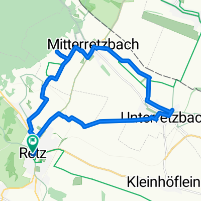
A cycling route starting in Retz, Lower Austria, Austria.
Overview
About this route
Day 1 - Variant 1c over Lancov and Podhradi; at the end over dirt road
- -:--
- Duration
- 51.9 km
- Distance
- 1,004 m
- Ascent
- 816 m
- Descent
- ---
- Avg. speed
- 511 m
- Max. altitude

Route quality
Waytypes & surfaces along the route
Waytypes
Track
27.5 km
(53 %)
Road
15.6 km
(30 %)
Surfaces
Paved
16.1 km
(31 %)
Unpaved
16.6 km
(32 %)
Asphalt
10.4 km
(20 %)
Unpaved (undefined)
8.8 km
(17 %)
Continue with Bikemap
Use, edit, or download this cycling route
You would like to ride Radausflug Uhercice - Tag 1; Var. 1c or customize it for your own trip? Here is what you can do with this Bikemap route:
Free features
- Save this route as favorite or in collections
- Copy & plan your own version of this route
- Sync your route with Garmin or Wahoo
Premium features
Free trial for 3 days, or one-time payment. More about Bikemap Premium.
- Navigate this route on iOS & Android
- Export a GPX / KML file of this route
- Create your custom printout (try it for free)
- Download this route for offline navigation
Discover more Premium features.
Get Bikemap PremiumFrom our community
Other popular routes starting in Retz
 Retz-Drosendorf
- Distance
- 39.7 km
- Ascent
- 671 m
- Descent
- 514 m
- Location
- Retz, Lower Austria, Austria
 Unterretzbachrunde 3
- Distance
- 58.9 km
- Ascent
- 335 m
- Descent
- 334 m
- Location
- Retz, Lower Austria, Austria
 RETZ Chardonnay Route
- Distance
- 48.7 km
- Ascent
- 503 m
- Descent
- 485 m
- Location
- Retz, Lower Austria, Austria
 Unterretzbachrunde 4
- Distance
- 28.8 km
- Ascent
- 273 m
- Descent
- 274 m
- Location
- Retz, Lower Austria, Austria
 Chardonnay kurz
- Distance
- 14.3 km
- Ascent
- 144 m
- Descent
- 147 m
- Location
- Retz, Lower Austria, Austria
 3. Weinradroute - Chardonnay aktuell
- Distance
- 48.9 km
- Ascent
- 452 m
- Descent
- 453 m
- Location
- Retz, Lower Austria, Austria
 Unterretzbachrunde 2
- Distance
- 26.5 km
- Ascent
- 224 m
- Descent
- 224 m
- Location
- Retz, Lower Austria, Austria
 Retz, Hardegg, Riegersburg, Retz
- Distance
- 51 km
- Ascent
- 761 m
- Descent
- 761 m
- Location
- Retz, Lower Austria, Austria
Open it in the app