Campionato italiano donne 2017
- 24 km
- 276 m
- 303 m
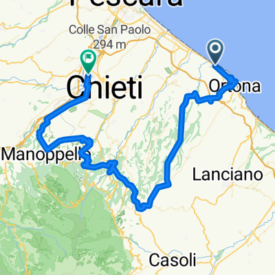
- Tollo, Abruzzo, Italy
A cycling route starting in Tollo, Abruzzo, Italy.
Overview
New short route of the Medio Fondo dei ColliTeatini Vini Tollo edition 2012. The route has been modified in the initial section approaching Orsogna by including the climb of Moggio. The central and final sections approaching Tollo remain unchanged with the final climb to arrive on via Roma in the center of the village.
created this 14 years ago
Route quality
Road
33 km
36 %
Quiet road
2.8 km
3 %
Paved
60.6 km
(66 %)
Asphalt
60.6 km
66 %
Undefined
31.2 km
34 %
Continue with Bikemap
You would like to ride Fondo Colli Teatini 2012 percorso corto 90 km or customize it for your own trip? Here is what you can do with this Bikemap route:
Free trial for 3 days, or one-time payment. More about Bikemap Premium.
Discover more Premium features.
Get Bikemap PremiumFrom our community
Open it in the app