
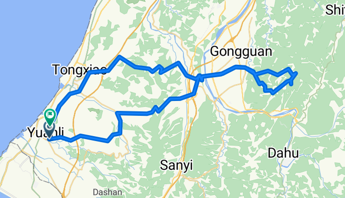
右右線八角凸協雲宮
Cycling route
Overview
About this route
經過虎頭崁到公館鄉右右線本路段最崎有35%
- -:--
- Duration
- 64.6 km
- Distance
- 1,364 m
- Ascent
- 1,375 m
- Descent
- ---
- Avg. speed
- 721 m
- Avg. speed

Route quality
Waytypes & surfaces along the route
Waytypes
Busy road
24.9 km
(38 %)
Road
24.2 km
(38 %)
Surfaces
Paved
12.1 km
(19 %)
Asphalt
12.1 km
(19 %)
Undefined
52.5 km
(81 %)
Route highlights
Points of interest along the route

Point of interest after 13.4 km
虎頭崁

Point of interest after 25.9 km
大坑村停車場

Point of interest after 28.5 km
厝下大崎

Point of interest after 31.8 km
八角凸

Point of interest after 33.1 km
協雲宮
Continue with Bikemap
Use, edit, or download this cycling route
You would like to ride 右右線八角凸協雲宮 or customize it for your own trip? Here is what you can do with this Bikemap route:
Free features
- Save this route as favorite or in collections
- Copy & plan your own version of this route
- Sync your route with Garmin or Wahoo
Premium features
Free trial for 3 days, or one-time payment. More about Bikemap Premium.
- Navigate this route on iOS & Android
- Export a GPX / KML file of this route
- Create your custom printout (try it for free)
- Download this route for offline navigation
Discover more Premium features.
Get Bikemap PremiumOpen it in the app