

一日北高三日環島衝衝衝【花北段】
A cycling route starting in Hualien City, Taiwan, Taiwan.
Overview
About this route
Convenience stores with toilets along the route: 0K: Xin Cheng Xin Lian Han 7-11 (next to An An Min Su, Taroko Bridge) 3K: Chong De 7-11 22K: He Ping Ke Lai Bao 7-11 (left) V 53K: Nan Ao 7-11 V 80K: Su Ao 7-11 V 91K: Wu Jie Bin Hai FamilyMart (Traditional Arts Center) 101K: Zhuang Wei 7-11 (left) 107K: Jiao Xi Jia Rong 7-11 (Tai 9 line 77K, Si Cheng train station, Wu Nuan restaurant intersection) V planned lunch stop 127K: Shi Pai Boundary Marker Park 146K: Ping Lin 7-11, FamilyMart V 173K: Xin Dian Guang Ming Street 7-11 V 183K: Liberty Square, Presidential Office Building 186K: Dadaocheng Pier
- -:--
- Duration
- 186.2 km
- Distance
- 2,059 m
- Ascent
- 2,087 m
- Descent
- ---
- Avg. speed
- ---
- Max. altitude

Route highlights
Points of interest along the route
Point of interest after 22 km
和平客來飽7-11
Point of interest after 53 km
南澳7-11
Point of interest after 79.9 km
蘇澳7-11
Drinking water after 91.4 km
五結濱海全家
Drinking water after 100.5 km
壯圍7-11
Point of interest after 106.5 km
礁溪嘉融7-11
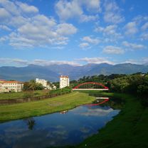
Photo after 126.9 km
石牌界碑公園
Point of interest after 146 km
坪林7-11、全家
Point of interest after 173.7 km
新店光明街7-11
Photo after 182.9 km
自由廣場
Photo after 183.6 km
總統府
Point of interest after 186.2 km
大稻埕碼頭
Continue with Bikemap
Use, edit, or download this cycling route
You would like to ride 一日北高三日環島衝衝衝【花北段】 or customize it for your own trip? Here is what you can do with this Bikemap route:
Free features
- Save this route as favorite or in collections
- Copy & plan your own version of this route
- Split it into stages to create a multi-day tour
- Sync your route with Garmin or Wahoo
Premium features
Free trial for 3 days, or one-time payment. More about Bikemap Premium.
- Navigate this route on iOS & Android
- Export a GPX / KML file of this route
- Create your custom printout (try it for free)
- Download this route for offline navigation
Discover more Premium features.
Get Bikemap PremiumFrom our community
Other popular routes starting in Hualien City
 Actual DAY 09r: Hualien to Taidong, 168km
- Distance
- 168.3 km
- Ascent
- 648 m
- Descent
- 619 m
- Location
- Hualien City, Taiwan, Taiwan
 20100417 環花東380超級挑戰隊 DAY1
- Distance
- 182.5 km
- Ascent
- 624 m
- Descent
- 596 m
- Location
- Hualien City, Taiwan, Taiwan
 花蓮台東7天環花東
- Distance
- 392.7 km
- Ascent
- 1,105 m
- Descent
- 1,103 m
- Location
- Hualien City, Taiwan, Taiwan
 東爽第二日
東爽第二日- Distance
- 306.3 km
- Ascent
- 1,261 m
- Descent
- 1,233 m
- Location
- Hualien City, Taiwan, Taiwan
 七星潭單車道
- Distance
- 9.7 km
- Ascent
- 44 m
- Descent
- 49 m
- Location
- Hualien City, Taiwan, Taiwan
 20190302美崙溪和咖小鈞吃飯
- Distance
- 19.8 km
- Ascent
- 536 m
- Descent
- 532 m
- Location
- Hualien City, Taiwan, Taiwan
 花蓮晨騎經典路線
- Distance
- 64.5 km
- Ascent
- 1,679 m
- Descent
- 1,687 m
- Location
- Hualien City, Taiwan, Taiwan
 花蓮火車站→瑞穗《193線》
- Distance
- 73.9 km
- Ascent
- 404 m
- Descent
- 331 m
- Location
- Hualien City, Taiwan, Taiwan
Open it in the app