
Fladnitz-Perschling Radweg
A cycling route starting in Herzogenburg, Lower Austria, Austria.
Overview
About this route
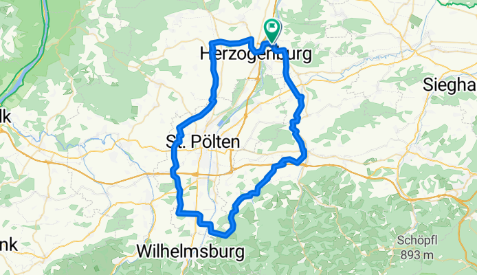
Fladnitz bike path towards St. Pölten, Fugging, Ragelsdorf, Weitzendorf, Reizersdorf to Ochsenburg and the Perschling route and the wind protection belt to St. Andrä
- 4 h 8 min
- Duration
- 65.5 km
- Distance
- 455 m
- Ascent
- 456 m
- Descent
- 15.8 km/h
- Avg. speed
- 398 m
- Max. altitude

Route quality
Waytypes & surfaces along the route
Waytypes
Road
28.8 km
(44 %)
Quiet road
16.4 km
(25 %)
Surfaces
Paved
34 km
(52 %)
Unpaved
6.5 km
(10 %)
Asphalt
30.8 km
(47 %)
Gravel
3.9 km
(6 %)
Continue with Bikemap
Use, edit, or download this cycling route
You would like to ride Fladnitz-Perschling Radweg or customize it for your own trip? Here is what you can do with this Bikemap route:
Free features
- Save this route as favorite or in collections
- Copy & plan your own version of this route
- Sync your route with Garmin or Wahoo
Premium features
Free trial for 3 days, or one-time payment. More about Bikemap Premium.
- Navigate this route on iOS & Android
- Export a GPX / KML file of this route
- Create your custom printout (try it for free)
- Download this route for offline navigation
Discover more Premium features.
Get Bikemap PremiumFrom our community
Other popular routes starting in Herzogenburg
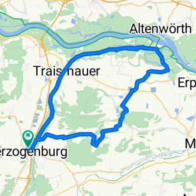 Entlang der Traisen
- Distance
- 42.5 km
- Ascent
- 157 m
- Descent
- 158 m
- Location
- Herzogenburg, Lower Austria, Austria
 Pottenbrunn (St. Pölten) - Donau - Pottenbrunn (St. Pölten) (Traisentalradweg) 35km, 2019.09.17.
- Distance
- 34.4 km
- Ascent
- 933 m
- Descent
- 931 m
- Location
- Herzogenburg, Lower Austria, Austria
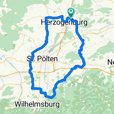 Fladnitz-Perschling Radweg
- Distance
- 65.5 km
- Ascent
- 455 m
- Descent
- 456 m
- Location
- Herzogenburg, Lower Austria, Austria
 Herzogenburg - Hollenburg -DRW - Herzogenburg
- Distance
- 35.7 km
- Ascent
- 412 m
- Descent
- 414 m
- Location
- Herzogenburg, Lower Austria, Austria
 Ossarner Hauptstraße, Herzogenburg nach Ossarner Hauptstraße, Herzogenburg
- Distance
- 41.4 km
- Ascent
- 223 m
- Descent
- 222 m
- Location
- Herzogenburg, Lower Austria, Austria
 RCO 2011 Höllental 2. Tag
- Distance
- 95.2 km
- Ascent
- 589 m
- Descent
- 273 m
- Location
- Herzogenburg, Lower Austria, Austria
 Krenntal 2, Herzogenburg nach Mühlweg 14, Ebersdorf
- Distance
- 25.1 km
- Ascent
- 108 m
- Descent
- 74 m
- Location
- Herzogenburg, Lower Austria, Austria
 Traismauer Mautern Krustetten
- Distance
- 47.8 km
- Ascent
- 452 m
- Descent
- 453 m
- Location
- Herzogenburg, Lower Austria, Austria
Open it in the app