

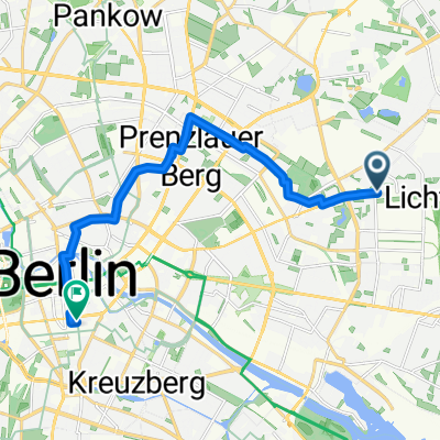
PB-Wartenberg-Hohenschönhausen-PB
A cycling route starting in Fennpfuhl, State of Berlin, Germany.
Overview
About this route
- -:--
- Duration
- 28.2 km
- Distance
- 128 m
- Ascent
- 128 m
- Descent
- ---
- Avg. speed
- 71 m
- Max. altitude

Route quality
Waytypes & surfaces along the route
Waytypes
Road
5.1 km
(18 %)
Quiet road
4.8 km
(17 %)
Surfaces
Paved
26 km
(92 %)
Asphalt
22.3 km
(79 %)
Concrete
3.7 km
(13 %)
Undefined
2.3 km
(8 %)
Continue with Bikemap
Use, edit, or download this cycling route
You would like to ride PB-Wartenberg-Hohenschönhausen-PB or customize it for your own trip? Here is what you can do with this Bikemap route:
Free features
- Save this route as favorite or in collections
- Copy & plan your own version of this route
- Sync your route with Garmin or Wahoo
Premium features
Free trial for 3 days, or one-time payment. More about Bikemap Premium.
- Navigate this route on iOS & Android
- Export a GPX / KML file of this route
- Create your custom printout (try it for free)
- Download this route for offline navigation
Discover more Premium features.
Get Bikemap PremiumFrom our community
Other popular routes starting in Fennpfuhl
 PB-Wartenberg-Hohenschönhausen-PB
- Distance
- 28.2 km
- Ascent
- 128 m
- Descent
- 128 m
- Location
- Fennpfuhl, State of Berlin, Germany
 Lanke Runde
- Distance
- 88.8 km
- Ascent
- 175 m
- Descent
- 159 m
- Location
- Fennpfuhl, State of Berlin, Germany
 Route in Berlin
- Distance
- 11.8 km
- Ascent
- 53 m
- Descent
- 66 m
- Location
- Fennpfuhl, State of Berlin, Germany
 Nördliche Schleife
- Distance
- 96.3 km
- Ascent
- 138 m
- Descent
- 138 m
- Location
- Fennpfuhl, State of Berlin, Germany
 Rund um den Müggelsee
- Distance
- 57.4 km
- Ascent
- 88 m
- Descent
- 106 m
- Location
- Fennpfuhl, State of Berlin, Germany
 091108 CX Wuhlewanderweg
- Distance
- 44.4 km
- Ascent
- 71 m
- Descent
- 73 m
- Location
- Fennpfuhl, State of Berlin, Germany
 Mittwochsrunde
- Distance
- 85.8 km
- Ascent
- 121 m
- Descent
- 122 m
- Location
- Fennpfuhl, State of Berlin, Germany
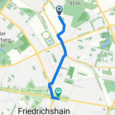 Storkower Straße, Berlin nach Frankfurter Allee, Berlin
- Distance
- 3 km
- Ascent
- 3 m
- Descent
- 17 m
- Location
- Fennpfuhl, State of Berlin, Germany
Open it in the app