

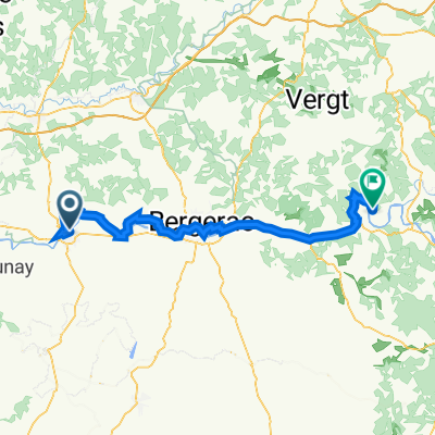
DAY ROUTE : SAINT-EMILION
A cycling route starting in Port-Sainte-Foy-et-Ponchapt, Nouvelle-Aquitaine, France.
Overview
About this route
- -:--
- Duration
- 63.9 km
- Distance
- 384 m
- Ascent
- 401 m
- Descent
- ---
- Avg. speed
- 106 m
- Max. altitude

Route quality
Waytypes & surfaces along the route
Waytypes
Road
26.2 km
(41 %)
Quiet road
25.6 km
(40 %)
Surfaces
Paved
44.8 km
(70 %)
Asphalt
44.8 km
(70 %)
Undefined
19.2 km
(30 %)
Route highlights
Points of interest along the route
Point of interest after 0.4 km
Office de tourisme de Sainte-Foy-La-Grande
Point of interest after 5.6 km
The Old Presbytery
Point of interest after 11 km
La Girarde
Point of interest after 15.3 km
Château Carbonneau
Point of interest after 18.8 km
Meeting point for Gîtes de la Cure & Château le Méjéan
Point of interest after 21 km
Château Destinée
Point of interest after 29.9 km
Le Relais de la Renaissance
Point of interest after 36.3 km
Château Haut-Clarisse
Continue with Bikemap
Use, edit, or download this cycling route
You would like to ride DAY ROUTE : SAINT-EMILION or customize it for your own trip? Here is what you can do with this Bikemap route:
Free features
- Save this route as favorite or in collections
- Copy & plan your own version of this route
- Sync your route with Garmin or Wahoo
Premium features
Free trial for 3 days, or one-time payment. More about Bikemap Premium.
- Navigate this route on iOS & Android
- Export a GPX / KML file of this route
- Create your custom printout (try it for free)
- Download this route for offline navigation
Discover more Premium features.
Get Bikemap PremiumFrom our community
Other popular routes starting in Port-Sainte-Foy-et-Ponchapt
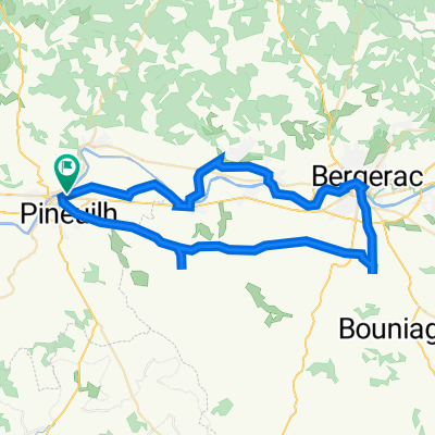
 Saussignac
- Distance
- 26.1 km
- Ascent
- 146 m
- Descent
- 144 m
- Location
- Port-Sainte-Foy-et-Ponchapt, Nouvelle-Aquitaine, France
 BASTIDE > BERGERAC > LALINDE > TREMOLAT
- Distance
- 74.8 km
- Ascent
- 447 m
- Descent
- 412 m
- Location
- Port-Sainte-Foy-et-Ponchapt, Nouvelle-Aquitaine, France
 LE FLEIX
- Distance
- 19.7 km
- Ascent
- 17 m
- Descent
- 17 m
- Location
- Port-Sainte-Foy-et-Ponchapt, Nouvelle-Aquitaine, France
 DAY ROUTE : SAINT-EMILION
- Distance
- 63.9 km
- Ascent
- 384 m
- Descent
- 401 m
- Location
- Port-Sainte-Foy-et-Ponchapt, Nouvelle-Aquitaine, France
 Sainte Foy à Plum 🛕
- Distance
- 23.4 km
- Ascent
- 235 m
- Descent
- 126 m
- Location
- Port-Sainte-Foy-et-Ponchapt, Nouvelle-Aquitaine, France
 SAUSSIGNAC, BERGERAC & MONBAZILLAC
- Distance
- 61.3 km
- Ascent
- 332 m
- Descent
- 332 m
- Location
- Port-Sainte-Foy-et-Ponchapt, Nouvelle-Aquitaine, France
 Steigung 1
- Distance
- 7.1 km
- Ascent
- 119 m
- Descent
- 19 m
- Location
- Port-Sainte-Foy-et-Ponchapt, Nouvelle-Aquitaine, France
 Lange Laufstrecke am Sonnabend
- Distance
- 18.4 km
- Ascent
- 219 m
- Descent
- 216 m
- Location
- Port-Sainte-Foy-et-Ponchapt, Nouvelle-Aquitaine, France
Open it in the app