

rit 4
A cycling route starting in Joyeuse, Auvergne-Rhône-Alpes, France.
Overview
About this route
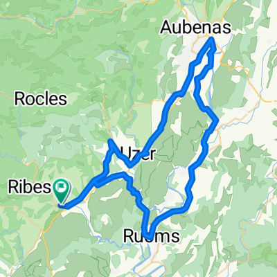
Stage 4: Col de Meyrand - Col du Pendu - Col de la Chavade - Col d'Eyvolle
- -:--
- Duration
- 130.4 km
- Distance
- 1,913 m
- Ascent
- 1,909 m
- Descent
- ---
- Avg. speed
- ---
- Max. altitude
Route quality
Waytypes & surfaces along the route
Waytypes
Road
26.1 km
(20 %)
Quiet road
6.5 km
(5 %)
Surfaces
Paved
78.3 km
(60 %)
Unpaved
1.3 km
(1 %)
Asphalt
74.4 km
(57 %)
Paved (undefined)
3.9 km
(3 %)
Continue with Bikemap
Use, edit, or download this cycling route
You would like to ride rit 4 or customize it for your own trip? Here is what you can do with this Bikemap route:
Free features
- Save this route as favorite or in collections
- Copy & plan your own version of this route
- Split it into stages to create a multi-day tour
- Sync your route with Garmin or Wahoo
Premium features
Free trial for 3 days, or one-time payment. More about Bikemap Premium.
- Navigate this route on iOS & Android
- Export a GPX / KML file of this route
- Create your custom printout (try it for free)
- Download this route for offline navigation
Discover more Premium features.
Get Bikemap PremiumFrom our community
Other popular routes starting in Joyeuse
 Königseteappe / Ardèches
- Distance
- 123.1 km
- Ascent
- 1,046 m
- Descent
- 1,066 m
- Location
- Joyeuse, Auvergne-Rhône-Alpes, France
 Francie2013-12
- Distance
- 60.1 km
- Ascent
- 667 m
- Descent
- 667 m
- Location
- Joyeuse, Auvergne-Rhône-Alpes, France
 ardeche 1
- Distance
- 89 km
- Ascent
- 1,278 m
- Descent
- 1,279 m
- Location
- Joyeuse, Auvergne-Rhône-Alpes, France
 Joyeuse-Rosières-Gorges de la Beaume-Labeaume-Champrenard-
- Distance
- 19.9 km
- Ascent
- 231 m
- Descent
- 245 m
- Location
- Joyeuse, Auvergne-Rhône-Alpes, France
 Joyeuse-Montréal-Vinezac-Lachapelle-St.Didier s/Aubenas-St.Gerrmain-Vogüé-St.Maurice-Ruoms-Prends toi-Garde-Joyeuse
- Distance
- 65 km
- Ascent
- 300 m
- Descent
- 300 m
- Location
- Joyeuse, Auvergne-Rhône-Alpes, France
 around Escourby Campsite
- Distance
- 37.8 km
- Ascent
- 697 m
- Descent
- 675 m
- Location
- Joyeuse, Auvergne-Rhône-Alpes, France
 Joyeuse - Beaumont
- Distance
- 26.4 km
- Ascent
- 635 m
- Descent
- 617 m
- Location
- Joyeuse, Auvergne-Rhône-Alpes, France
 rit 4
rit 4- Distance
- 130.4 km
- Ascent
- 1,913 m
- Descent
- 1,909 m
- Location
- Joyeuse, Auvergne-Rhône-Alpes, France
Open it in the app