

tour de benetan mairie
A cycling route starting in Trept, Auvergne-Rhône-Alpes, France.
Overview
About this route
- -:--
- Duration
- 6.4 km
- Distance
- 135 m
- Ascent
- 136 m
- Descent
- ---
- Avg. speed
- 399 m
- Max. altitude

Route quality
Waytypes & surfaces along the route
Waytypes
Track
4.6 km
(72 %)
Quiet road
0.9 km
(14 %)
Surfaces
Paved
0.1 km
(2 %)
Unpaved
2.5 km
(39 %)
Ground
2.1 km
(33 %)
Gravel
0.3 km
(5 %)
Continue with Bikemap
Use, edit, or download this cycling route
You would like to ride tour de benetan mairie or customize it for your own trip? Here is what you can do with this Bikemap route:
Free features
- Save this route as favorite or in collections
- Copy & plan your own version of this route
- Sync your route with Garmin or Wahoo
Premium features
Free trial for 3 days, or one-time payment. More about Bikemap Premium.
- Navigate this route on iOS & Android
- Export a GPX / KML file of this route
- Create your custom printout (try it for free)
- Download this route for offline navigation
Discover more Premium features.
Get Bikemap PremiumFrom our community
Other popular routes starting in Trept
 tour de benetan mairie
- Distance
- 6.4 km
- Ascent
- 135 m
- Descent
- 136 m
- Location
- Trept, Auvergne-Rhône-Alpes, France
 gorges verbois cascade roche
- Distance
- 38.7 km
- Ascent
- 636 m
- Descent
- 635 m
- Location
- Trept, Auvergne-Rhône-Alpes, France
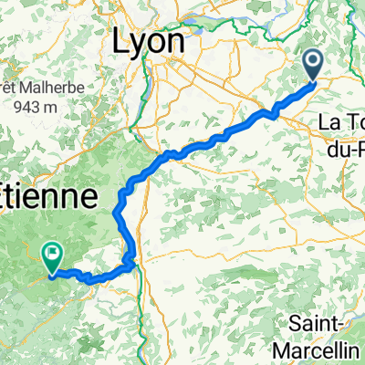 Trept - Bourg-Argental
- Distance
- 109.3 km
- Ascent
- 1,512 m
- Descent
- 1,102 m
- Location
- Trept, Auvergne-Rhône-Alpes, France
 st marcel veyssilieu moras crémieu
- Distance
- 36 km
- Ascent
- 458 m
- Descent
- 460 m
- Location
- Trept, Auvergne-Rhône-Alpes, France
 2011 Cycle Tour Rhone Alps - Part 1
- Distance
- 178.7 km
- Ascent
- 2,546 m
- Descent
- 2,432 m
- Location
- Trept, Auvergne-Rhône-Alpes, France
 Route in Dizimieu
- Distance
- 6.8 km
- Ascent
- 131 m
- Descent
- 131 m
- Location
- Trept, Auvergne-Rhône-Alpes, France
 Route to 168 Rue de la Gare, 38460 Vénérieu
- Distance
- 41 km
- Ascent
- 558 m
- Descent
- 559 m
- Location
- Trept, Auvergne-Rhône-Alpes, France
 loup1
loup1- Distance
- 14.3 km
- Ascent
- 221 m
- Descent
- 221 m
- Location
- Trept, Auvergne-Rhône-Alpes, France
Open it in the app