

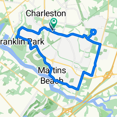
Bordentown/Towpath/Burlington
A cycling route starting in Willingboro, New Jersey, United States of America.
Overview
About this route
Route up to the start of the Delaware Towpath, then back
- -:--
- Duration
- 63.3 km
- Distance
- 223 m
- Ascent
- 223 m
- Descent
- ---
- Avg. speed
- 33 m
- Avg. speed

Route quality
Waytypes & surfaces along the route
Waytypes
Road
23.7 km
(37 %)
Cycleway
19 km
(30 %)
Surfaces
Paved
17.3 km
(27 %)
Unpaved
4.4 km
(7 %)
Asphalt
17.2 km
(27 %)
Gravel
4.4 km
(7 %)
Continue with Bikemap
Use, edit, or download this cycling route
You would like to ride Bordentown/Towpath/Burlington or customize it for your own trip? Here is what you can do with this Bikemap route:
Free features
- Save this route as favorite or in collections
- Copy & plan your own version of this route
- Sync your route with Garmin or Wahoo
Premium features
Free trial for 3 days, or one-time payment. More about Bikemap Premium.
- Navigate this route on iOS & Android
- Export a GPX / KML file of this route
- Create your custom printout (try it for free)
- Download this route for offline navigation
Discover more Premium features.
Get Bikemap PremiumFrom our community
Other popular routes starting in Willingboro
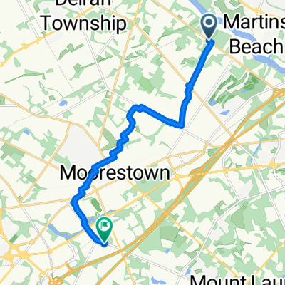 Tudor Ln, Moorestown to E Gate Dr, Mount Laurel
- Distance
- 12 km
- Ascent
- 38 m
- Descent
- 42 m
- Location
- Willingboro, New Jersey, United States of America
 Levitt Pkwy, Willingboro to 711 Public Rd, Palmyra
- Distance
- 18.5 km
- Ascent
- 134 m
- Descent
- 139 m
- Location
- Willingboro, New Jersey, United States of America
 Bordentown/Towpath/Burlington
- Distance
- 63.3 km
- Ascent
- 223 m
- Descent
- 223 m
- Location
- Willingboro, New Jersey, United States of America
 Meribrook Circle to Meribrook Circle
- Distance
- 16.4 km
- Ascent
- 91 m
- Descent
- 57 m
- Location
- Willingboro, New Jersey, United States of America
 Meribrook Circle to Meribrook Circle
- Distance
- 27.9 km
- Ascent
- 66 m
- Descent
- 28 m
- Location
- Willingboro, New Jersey, United States of America
 Meribrook Circle to Meribrook Circle
- Distance
- 34.6 km
- Ascent
- 75 m
- Descent
- 36 m
- Location
- Willingboro, New Jersey, United States of America
 Meribrook Circle to Meribrook Circle
- Distance
- 17 km
- Ascent
- 109 m
- Descent
- 67 m
- Location
- Willingboro, New Jersey, United States of America
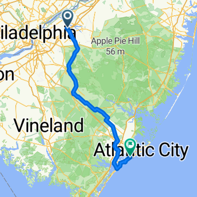 Hogan Way, Moorestown to N Rosborough Ave, Ventnor City
- Distance
- 116.4 km
- Ascent
- 238 m
- Descent
- 255 m
- Location
- Willingboro, New Jersey, United States of America
Open it in the app