Bears - who cares!
A cycling route starting in Lovran, Istria County, Croatia.
Overview
About this route
- -:--
- Duration
- 24.3 km
- Distance
- 641 m
- Ascent
- 641 m
- Descent
- ---
- Avg. speed
- ---
- Max. altitude
Route quality
Waytypes & surfaces along the route
Waytypes
Track
21.6 km
(89 %)
Road
1.9 km
(8 %)
Surfaces
Paved
1.7 km
(7 %)
Unpaved
15.5 km
(64 %)
Gravel
15.5 km
(64 %)
Asphalt
1.7 km
(7 %)
Undefined
7 km
(29 %)
Route highlights
Points of interest along the route
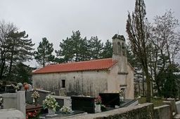
Photo after 0.1 km
crkva Sv. Križa iz 17. st.
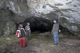
Point of interest after 2.6 km
"Klanjčeva peć" - pećina, mezolitska naseobina
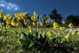
Point of interest after 4.7 km
Prijelaz iz prigorskog u planinski pojas, vidljiva promjena vegetacijskog ekosustava
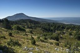
Point of interest after 5.2 km
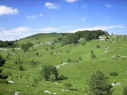
Point of interest after 5.6 km
Ošalj vrh

Photo after 6.5 km
"Gradec" - prapovijesna gradina, naselje ljudi brončanog doba
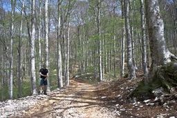
Point of interest after 6.7 km
Ulaz u sastojinu planinske bukve, uživajte u hladovini i monumentalnosti šume
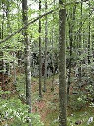
Point of interest after 7.4 km

Point of interest after 7.6 km
raskrsnica - desno put za Bončića kuću, između vrhova Veliki i Mali Planik
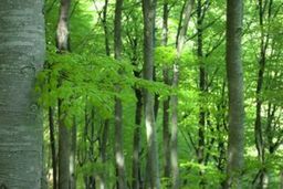
Point of interest after 8.4 km
Ovdje napuštate šumarsku cestu i skrećete udesno na stari put prema Brgucu. Šumarska cesta vodi dalje preko Moljevih dvora do Bresta
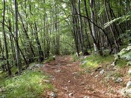
Point of interest after 8.8 km
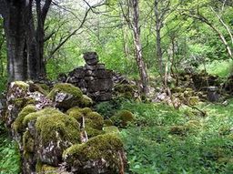
Point of interest after 8.9 km
"Boljunski dol" - srednjovjekovno obitavalište istarskih stočara prilikom ljetnog uzgona stoke. Ostaci pastirskih stanova i pojilišta.
Point of interest after 10.4 km
desno uzbrdo put za Korita
Point of interest after 13.1 km
Kaptirani mjesni izvor, pitka voda
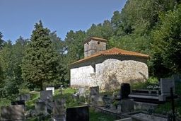
Photo after 13.1 km
crkva Sv. Luke Evanđeliste 1580.
Point of interest after 13.3 km
Brgudac, gotovo nenaseljen, kao čuveno partizansko uporište teško stradao u 2. svjetskom ratu 1944. god., tragovi vidljivi i danas
Point of interest after 13.9 km
"Goričica" - mjesto ispraćaja i rastanaka mještana Brguca prilikom odlaska u dijasporu ili ratove, duboko emotivan tekst na spomen obilježju.
Point of interest after 18.2 km
Vojni poligon bivše JNA, ostaci tenkovskih meta, nalazište gljiva sunčanica
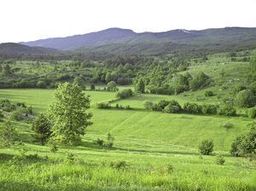
Point of interest after 18.7 km
"Moljevi dvori" - pastirski stanovi, slikovite livade
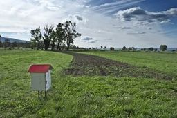
Photo after 23.5 km
"Polje" - nezaboravan vidik, uzletište paraglajdera, nalazište gljiva
Continue with Bikemap
Use, edit, or download this cycling route
You would like to ride Bears - who cares! or customize it for your own trip? Here is what you can do with this Bikemap route:
Free features
- Save this route as favorite or in collections
- Copy & plan your own version of this route
- Sync your route with Garmin or Wahoo
Premium features
Free trial for 3 days, or one-time payment. More about Bikemap Premium.
- Navigate this route on iOS & Android
- Export a GPX / KML file of this route
- Create your custom printout (try it for free)
- Download this route for offline navigation
Discover more Premium features.
Get Bikemap PremiumFrom our community
Other popular routes starting in Lovran
 Bears - who cares!
- Distance
- 24.3 km
- Ascent
- 641 m
- Descent
- 641 m
- Location
- Lovran, Istria County, Croatia
 Ičići-Učka_06/2021
- Distance
- 23.4 km
- Ascent
- 1,406 m
- Descent
- 13 m
- Location
- Lovran, Istria County, Croatia
 Up to the top of Istria
- Distance
- 46.9 km
- Ascent
- 1,394 m
- Descent
- 1,394 m
- Location
- Lovran, Istria County, Croatia
 47. Poklon_Korita_Brest_Poklon
- Distance
- 32.1 km
- Ascent
- 825 m
- Descent
- 825 m
- Location
- Lovran, Istria County, Croatia
 Poklon-Senozet-Moljevi dvori-Brest-Poklon (Ucka bike 7)
- Distance
- 23.3 km
- Ascent
- 738 m
- Descent
- 738 m
- Location
- Lovran, Istria County, Croatia
 20. LK Brdo - Lisina -LK Brdo
- Distance
- 11.5 km
- Ascent
- 394 m
- Descent
- 349 m
- Location
- Lovran, Istria County, Croatia
 LK Brdo - Lisina -LK Brdo
- Distance
- 11.5 km
- Ascent
- 394 m
- Descent
- 349 m
- Location
- Lovran, Istria County, Croatia
 Mala Ucka - Medveja
- Distance
- 5.9 km
- Ascent
- 12 m
- Descent
- 1,018 m
- Location
- Lovran, Istria County, Croatia
Open it in the app

