

20231112_おおたわら 激ポタ60
A cycling route starting in Ōtawara, Tochigi, Japan.
Overview
About this route
RwGPS 59.7Km +1,100m/-1,097m 公式MAP Download ~コース概要~ まずは、八溝七福神を祀るお寺を2か所巡りご利益を...。 なかがわ水遊園から大田原市の激坂スポット1「コテヤン」山頂へ。ここは富士山が見える絶景スポット!下ると禅の修行場「雲厳寺」。次に待つ激坂2!木佐美トンネル。ここはツール・ド・とちぎのコースでKomになった12%の坂!トンネルを過ぎた先の右カーブでは選手が曲がれず突っ込みガードレールを超えた場所なのでスピード要注意!坂を下り左に曲がると激坂3!ゴールデンウッドゴルフ場のピークを越えると、三峠制覇。しかしその後も平地ではなくピアートホールと芭蕉の館までの坂を満喫し、数カ所の丘をクリアすると距離59.8kmで獲得標高1,099m達成です。レースでは有りませんので坂をのんびり楽しんで下さい。また、このコース上及び付近には「俺が危い」通称おれあぶ看板が3ヵ所あります(1個はコース外)。雲厳寺バス停・木佐美トンネル丁字路先・両郷交差点(おれあぶ交差点)
- 11 h 45 min
- Duration
- 59.7 km
- Distance
- 1,216 m
- Ascent
- 1,215 m
- Descent
- 5.1 km/h
- Avg. speed
- 502 m
- Max. altitude

Route photos


Continue with Bikemap
Use, edit, or download this cycling route
You would like to ride 20231112_おおたわら 激ポタ60 or customize it for your own trip? Here is what you can do with this Bikemap route:
Free features
- Save this route as favorite or in collections
- Copy & plan your own version of this route
- Sync your route with Garmin or Wahoo
Premium features
Free trial for 3 days, or one-time payment. More about Bikemap Premium.
- Navigate this route on iOS & Android
- Export a GPX / KML file of this route
- Create your custom printout (try it for free)
- Download this route for offline navigation
Discover more Premium features.
Get Bikemap PremiumFrom our community
Other popular routes starting in Ōtawara
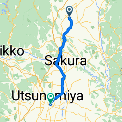 永田町, 那須塩原市へ川向町, 宇都宮市
- Distance
- 50.7 km
- Ascent
- 265 m
- Descent
- 386 m
- Location
- Ōtawara, Tochigi, Japan
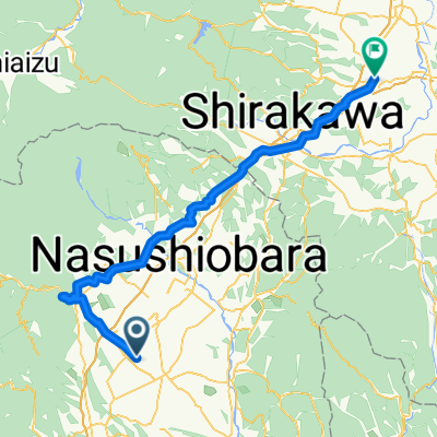 Day 7 Nasushiobara to Yabuki Station
- Distance
- 75.2 km
- Ascent
- 1,142 m
- Descent
- 1,097 m
- Location
- Ōtawara, Tochigi, Japan
 20201115_おおたわら丘ポタ30 2020
- Distance
- 30.3 km
- Ascent
- 302 m
- Descent
- 304 m
- Location
- Ōtawara, Tochigi, Japan
 大田原市 to 3丁目, 大田原市
- Distance
- 11.6 km
- Ascent
- 57 m
- Descent
- 50 m
- Location
- Ōtawara, Tochigi, Japan
 20231112_おおたわら 激ポタ60
- Distance
- 59.7 km
- Ascent
- 1,216 m
- Descent
- 1,215 m
- Location
- Ōtawara, Tochigi, Japan
 Nichien Momiji Line - Nikko 2days
- Distance
- 135.9 km
- Ascent
- 2,914 m
- Descent
- 2,853 m
- Location
- Ōtawara, Tochigi, Japan
 421-PC3-PC4
- Distance
- 52.7 km
- Ascent
- 344 m
- Descent
- 502 m
- Location
- Ōtawara, Tochigi, Japan
 day 8 part two
- Distance
- 4.4 km
- Ascent
- 24 m
- Descent
- 12 m
- Location
- Ōtawara, Tochigi, Japan
Open it in the app