salida bizi wizi 15/02/2012
A cycling route starting in Gilet, Valencia, Spain.
Overview
About this route
- -:--
- Duration
- 33.9 km
- Distance
- 771 m
- Ascent
- 771 m
- Descent
- ---
- Avg. speed
- ---
- Avg. speed
Route quality
Waytypes & surfaces along the route
Waytypes
Track
17.3 km
(51 %)
Quiet road
13.5 km
(40 %)
Surfaces
Paved
4.3 km
(13 %)
Unpaved
12.3 km
(36 %)
Unpaved (undefined)
6.3 km
(19 %)
Gravel
4.7 km
(14 %)
Route highlights
Points of interest along the route
Point of interest after 14.6 km
Point of interest after 23 km
Almuerzo
Point of interest after 28.9 km
Continue with Bikemap
Use, edit, or download this cycling route
You would like to ride salida bizi wizi 15/02/2012 or customize it for your own trip? Here is what you can do with this Bikemap route:
Free features
- Save this route as favorite or in collections
- Copy & plan your own version of this route
- Sync your route with Garmin or Wahoo
Premium features
Free trial for 3 days, or one-time payment. More about Bikemap Premium.
- Navigate this route on iOS & Android
- Export a GPX / KML file of this route
- Create your custom printout (try it for free)
- Download this route for offline navigation
Discover more Premium features.
Get Bikemap PremiumFrom our community
Other popular routes starting in Gilet
- SANTO ESPIRITU ANTENAS GARBÍ
- Distance
- 28.5 km
- Ascent
- 800 m
- Descent
- 802 m
- Location
- Gilet, Valencia, Spain
- Gilet-Picaio-Alfara Baronia
- Distance
- 38.8 km
- Ascent
- 485 m
- Descent
- 487 m
- Location
- Gilet, Valencia, Spain
- Circular Gilet-Segart-Mirador Garbi-Gilet
- Distance
- 26.9 km
- Ascent
- 578 m
- Descent
- 578 m
- Location
- Gilet, Valencia, Spain
- salida bizi wizi 15/02/2012
- Distance
- 33.9 km
- Ascent
- 771 m
- Descent
- 771 m
- Location
- Gilet, Valencia, Spain
- Rest 
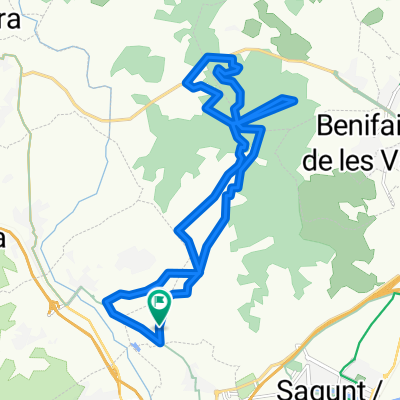
Reino - Casa del Dragon 12 de noviembre 12:09
- Distance
- 6.2 km
- Ascent
- 203 m
- Descent
- 215 m
- Location
- Gilet, Valencia, Spain
- Petrés - Santo Espiritu - Pico Aguila- Petrés 2010
- Distance
- 21.9 km
- Ascent
- 423 m
- Descent
- 425 m
- Location
- Gilet, Valencia, Spain
- Subida a Monte Picayo desde Petres 2010
- Distance
- 23.4 km
- Ascent
- 501 m
- Descent
- 498 m
- Location
- Gilet, Valencia, Spain
- Gilet - Pico del Aguila - La Mola 2011
- Distance
- 22.3 km
- Ascent
- 484 m
- Descent
- 491 m
- Location
- Gilet, Valencia, Spain
Open it in the app