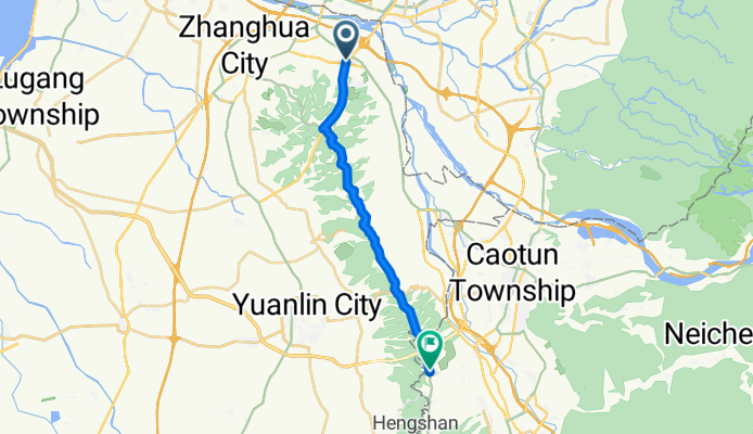
中彰高架橋~~鳳山寺
A cycling route starting in Chang-hua, Taiwan, Taiwan.
Overview
About this route
- -:--
- Duration
- 20 km
- Distance
- 514 m
- Ascent
- 225 m
- Descent
- ---
- Avg. speed
- 323 m
- Avg. speed
Route quality
Waytypes & surfaces along the route
Waytypes
Busy road
14.9 km
(75 %)
Access road
2.8 km
(14 %)
Surfaces
Paved
15.9 km
(80 %)
Asphalt
15.9 km
(80 %)
Undefined
4 km
(20 %)
Continue with Bikemap
Use, edit, or download this cycling route
You would like to ride 中彰高架橋~~鳳山寺 or customize it for your own trip? Here is what you can do with this Bikemap route:
Free features
- Save this route as favorite or in collections
- Copy & plan your own version of this route
- Sync your route with Garmin or Wahoo
Premium features
Free trial for 3 days, or one-time payment. More about Bikemap Premium.
- Navigate this route on iOS & Android
- Export a GPX / KML file of this route
- Create your custom printout (try it for free)
- Download this route for offline navigation
Discover more Premium features.
Get Bikemap PremiumFrom our community
Other popular routes starting in Chang-hua
- 東外環-三分橋-員林大碗公
- Distance
- 42.9 km
- Ascent
- 368 m
- Descent
- 371 m
- Location
- Chang-hua, Taiwan, Taiwan
- 虎山岩-日月山景
- Distance
- 19.7 km
- Ascent
- 237 m
- Descent
- 232 m
- Location
- Chang-hua, Taiwan, Taiwan
- 別毛山林道
- Distance
- 126.7 km
- Ascent
- 1,311 m
- Descent
- 1,311 m
- Location
- Chang-hua, Taiwan, Taiwan
- 2011_09_25 第二屆 環化賽
- Distance
- 107.8 km
- Ascent
- 458 m
- Descent
- 460 m
- Location
- Chang-hua, Taiwan, Taiwan
- 穩定的乘坐 烏日區
- Distance
- 38 km
- Ascent
- 38 m
- Descent
- 69 m
- Location
- Chang-hua, Taiwan, Taiwan
- C2C3 DAY1彰化-潭雅神-后豐-大甲
- Distance
- 72.4 km
- Ascent
- 393 m
- Descent
- 354 m
- Location
- Chang-hua, Taiwan, Taiwan
- 中彰轉-139 路段 車少空氣好
- Distance
- 35 km
- Ascent
- 452 m
- Descent
- 425 m
- Location
- Chang-hua, Taiwan, Taiwan
- 2009.4.12 快官~八卦山~賞鷹平臺~楊桃崎~禾家~四面佛O型
- Distance
- 30.2 km
- Ascent
- 572 m
- Descent
- 568 m
- Location
- Chang-hua, Taiwan, Taiwan
Open it in the app