
Locks Docks But No Smoking Ferry Ride 2
A cycling route starting in Camberwell, England, United Kingdom.
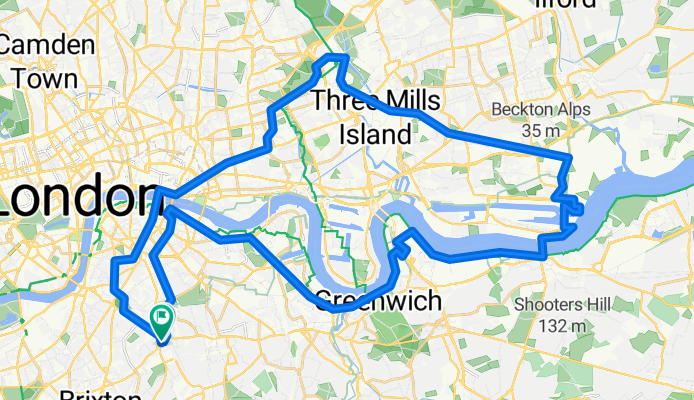
Overview
About this route
The smoking ferries at Woolwich are no more and even the new ones are not operating at weekends, so we will cross to the north side of the Thames by using the Woolwich Foot Tunnel instead.
On this ride, we will be able to take a look at the works going on to build the Silvertown Tunnel. This, of course, is the bête noire of the cycling community, but, at the same time, is essential for reducing congestion on the Blackwall Tunnel Southern Approach and for supporting the redevelopment of the Royal Docks area.
We will stop for a mid-ride coffee break at the Well Bean Café, 1-2 Upper Dock Walk, London E16 2GU. We will then return via the Greenway to the View Tube in Stratford, where the ride will finish.
Devised by Cyclists in Southwark
- 3 h 2 min
- Duration
- 47.9 km
- Distance
- 173 m
- Ascent
- 172 m
- Descent
- 15.8 km/h
- Avg. speed
- 37 m
- Max. altitude
Route quality
Waytypes & surfaces along the route
Waytypes
Cycleway
26 km
(54 %)
Quiet road
10.7 km
(22 %)
Surfaces
Paved
44.9 km
(94 %)
Asphalt
37.4 km
(78 %)
Paving stones
4.3 km
(9 %)
Continue with Bikemap
Use, edit, or download this cycling route
You would like to ride Locks Docks But No Smoking Ferry Ride 2 or customize it for your own trip? Here is what you can do with this Bikemap route:
Free features
- Save this route as favorite or in collections
- Copy & plan your own version of this route
- Sync your route with Garmin or Wahoo
Premium features
Free trial for 3 days, or one-time payment. More about Bikemap Premium.
- Navigate this route on iOS & Android
- Export a GPX / KML file of this route
- Create your custom printout (try it for free)
- Download this route for offline navigation
Discover more Premium features.
Get Bikemap PremiumFrom our community
Other popular routes starting in Camberwell
 Camberwell Purfleet Circular
- Distance
- 73 km
- Ascent
- 202 m
- Descent
- 203 m
- Location
- Camberwell, England, United Kingdom
 Peckham to Peckham via parks, hills and a cemetery.
- Distance
- 16.4 km
- Ascent
- 155 m
- Descent
- 155 m
- Location
- Camberwell, England, United Kingdom
 Burgess Park to Holland Park and Brompton Cemetery
- Distance
- 24.3 km
- Ascent
- 85 m
- Descent
- 84 m
- Location
- Camberwell, England, United Kingdom
 Purfleet RSPB Rainham Marshes
- Distance
- 32.5 km
- Ascent
- 76 m
- Descent
- 83 m
- Location
- Camberwell, England, United Kingdom
 Moderate route in London
- Distance
- 11.4 km
- Ascent
- 0 m
- Descent
- 3 m
- Location
- Camberwell, England, United Kingdom
 Ravensbourne and Wandle Circular
- Distance
- 51.6 km
- Ascent
- 167 m
- Descent
- 165 m
- Location
- Camberwell, England, United Kingdom
 Views from the South Cycle Ride
- Distance
- 18.4 km
- Ascent
- 148 m
- Descent
- 145 m
- Location
- Camberwell, England, United Kingdom
 SE London 2
- Distance
- 49.6 km
- Ascent
- 250 m
- Descent
- 250 m
- Location
- Camberwell, England, United Kingdom
Open it in the app