

Tour 10 (Landkreis Amberg-Sulzbach)
A cycling route starting in Kastl, Bavaria, Germany.
Overview
About this route
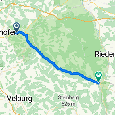
On this tour, the more challenging routes in Birgland (old cultural landscape/European watershed/rare orchid species) are easy to manage. From Kastl (basilica/monastery fortress), the bike path climbs steadily up to Schwend. Just before Schwend, you have a good view over the landscape. From here you can directly cycle to Poppberg (with 656m being the highest viewpoint in the district/castle ruins). If the view from Poppberg does not reward you for all the effort, you will be completely rewarded on the return journey down to the Lauterachtal valley.
- -:--
- Duration
- 24.6 km
- Distance
- 473 m
- Ascent
- 450 m
- Descent
- ---
- Avg. speed
- 612 m
- Max. altitude
Route quality
Waytypes & surfaces along the route
Waytypes
Quiet road
21.4 km
(87 %)
Track
2 km
(8 %)
Surfaces
Paved
10.1 km
(41 %)
Unpaved
1.2 km
(5 %)
Asphalt
9.6 km
(39 %)
Gravel
0.7 km
(3 %)
Continue with Bikemap
Use, edit, or download this cycling route
You would like to ride Tour 10 (Landkreis Amberg-Sulzbach) or customize it for your own trip? Here is what you can do with this Bikemap route:
Free features
- Save this route as favorite or in collections
- Copy & plan your own version of this route
- Sync your route with Garmin or Wahoo
Premium features
Free trial for 3 days, or one-time payment. More about Bikemap Premium.
- Navigate this route on iOS & Android
- Export a GPX / KML file of this route
- Create your custom printout (try it for free)
- Download this route for offline navigation
Discover more Premium features.
Get Bikemap PremiumFrom our community
Other popular routes starting in Kastl
 kastl zeitfahren
- Distance
- 21 km
- Ascent
- 323 m
- Descent
- 290 m
- Location
- Kastl, Bavaria, Germany
 2011 Markt Kastl-Schwandorf
- Distance
- 68.6 km
- Ascent
- 195 m
- Descent
- 271 m
- Location
- Kastl, Bavaria, Germany
 Radrunde durch Kastl
- Distance
- 16.4 km
- Ascent
- 181 m
- Descent
- 176 m
- Location
- Kastl, Bavaria, Germany
 Ausflug in den Vorwald (mit 1 ÜN)
- Distance
- 146.6 km
- Ascent
- 873 m
- Descent
- 867 m
- Location
- Kastl, Bavaria, Germany
 Kastl Lauterachtalweg Schweppermann Weg
- Distance
- 67 km
- Ascent
- 283 m
- Descent
- 286 m
- Location
- Kastl, Bavaria, Germany
 Route Schweppermann bis Schmidmühlen
- Distance
- 25.7 km
- Ascent
- 542 m
- Descent
- 637 m
- Location
- Kastl, Bavaria, Germany
 Mountainbike-Rundtour Fränkische Alb
- Distance
- 27.9 km
- Ascent
- 460 m
- Descent
- 446 m
- Location
- Kastl, Bavaria, Germany
 2011 Runde um Kastl/Oberpfalz
- Distance
- 17.5 km
- Ascent
- 242 m
- Descent
- 246 m
- Location
- Kastl, Bavaria, Germany
Open it in the app