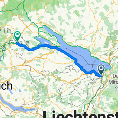
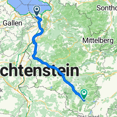
Hirschberg, Gäbris 2023 kurze Variante
A cycling route starting in Höchst, Vorarlberg, Austria.
Overview
About this route
- -:--
- Duration
- 68.4 km
- Distance
- 1,690 m
- Ascent
- 1,686 m
- Descent
- ---
- Avg. speed
- 1,230 m
- Max. altitude
Route quality
Waytypes & surfaces along the route
Waytypes
Track
32.1 km
(47 %)
Quiet road
19.1 km
(28 %)
Surfaces
Paved
36.2 km
(53 %)
Unpaved
23.2 km
(34 %)
Asphalt
33.5 km
(49 %)
Gravel
17.8 km
(26 %)
Continue with Bikemap
Use, edit, or download this cycling route
You would like to ride Hirschberg, Gäbris 2023 kurze Variante or customize it for your own trip? Here is what you can do with this Bikemap route:
Free features
- Save this route as favorite or in collections
- Copy & plan your own version of this route
- Sync your route with Garmin or Wahoo
Premium features
Free trial for 3 days, or one-time payment. More about Bikemap Premium.
- Navigate this route on iOS & Android
- Export a GPX / KML file of this route
- Create your custom printout (try it for free)
- Download this route for offline navigation
Discover more Premium features.
Get Bikemap PremiumFrom our community
Other popular routes starting in Höchst
- bodensee -lago maggiore
- Distance
- 321.9 km
- Ascent
- 6,301 m
- Descent
- 6,494 m
- Location
- Höchst, Vorarlberg, Austria
- Bodensee Radltag 2 - 26.6.22 Höchst nach Konstanz
- Distance
- 52.9 km
- Ascent
- 208 m
- Descent
- 202 m
- Location
- Höchst, Vorarlberg, Austria
- 027 - 2014
- Distance
- 114.1 km
- Ascent
- 504 m
- Descent
- 333 m
- Location
- Höchst, Vorarlberg, Austria
- Höchst - Rheineck - Wienacht - Heiden - Trogen - Gäbris - St. Anton - Berneck - Höchst
- Distance
- 62.1 km
- Ascent
- 1,249 m
- Descent
- 1,249 m
- Location
- Höchst, Vorarlberg, Austria
- Höchst > St. Anton > Heiden > Höchst
- Distance
- 35.3 km
- Ascent
- 0 m
- Descent
- 0 m
- Location
- Höchst, Vorarlberg, Austria
- Lustnau-Pfänder-zurück
- Distance
- 48.1 km
- Ascent
- 711 m
- Descent
- 711 m
- Location
- Höchst, Vorarlberg, Austria
- BS3 - Zur Linde (Höchst) - Augustiner Tor Konstanz
- Distance
- 52.5 km
- Ascent
- 60 m
- Descent
- 61 m
- Location
- Höchst, Vorarlberg, Austria
- Schäflisberg - Heldsberg - Walzenhausen und retour
- Distance
- 13.8 km
- Ascent
- 455 m
- Descent
- 456 m
- Location
- Höchst, Vorarlberg, Austria
Open it in the app