

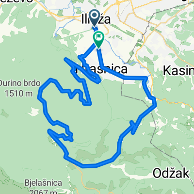
lukavica>tvrdimići>jasik&>brus>bistrik kula
A cycling route starting in Sarajevo, Federation of Bosnia and Herzegovina, Bosnia and Herzegovina.
Overview
About this route
lukavica>tvrdimići>jasik&>brus>bistrik kula
- -:--
- Duration
- 45.3 km
- Distance
- 1,519 m
- Ascent
- 1,517 m
- Descent
- ---
- Avg. speed
- 1,321 m
- Max. altitude

Route quality
Waytypes & surfaces along the route
Waytypes
Quiet road
6.3 km
(14 %)
Pedestrian area
3.2 km
(7 %)
Surfaces
Paved
37.2 km
(82 %)
Unpaved
0.5 km
(1 %)
Asphalt
36.3 km
(80 %)
Concrete
0.9 km
(2 %)
Continue with Bikemap
Use, edit, or download this cycling route
You would like to ride lukavica>tvrdimići>jasik&>brus>bistrik kula or customize it for your own trip? Here is what you can do with this Bikemap route:
Free features
- Save this route as favorite or in collections
- Copy & plan your own version of this route
- Sync your route with Garmin or Wahoo
Premium features
Free trial for 3 days, or one-time payment. More about Bikemap Premium.
- Navigate this route on iOS & Android
- Export a GPX / KML file of this route
- Create your custom printout (try it for free)
- Download this route for offline navigation
Discover more Premium features.
Get Bikemap PremiumFrom our community
Other popular routes starting in Sarajevo
 Voyage de malade
- Distance
- 1,793.6 km
- Ascent
- 2,905 m
- Descent
- 3,212 m
- Location
- Sarajevo, Federation of Bosnia and Herzegovina, Bosnia and Herzegovina
 lukavica>tvrdimići>jasik&>brus>bistrik kula
- Distance
- 45.3 km
- Ascent
- 1,519 m
- Descent
- 1,517 m
- Location
- Sarajevo, Federation of Bosnia and Herzegovina, Bosnia and Herzegovina
 From Sarajevo to Visoko
- Distance
- 55.3 km
- Ascent
- 1,350 m
- Descent
- 1,441 m
- Location
- Sarajevo, Federation of Bosnia and Herzegovina, Bosnia and Herzegovina
 first alternative Sarajevo-milano
- Distance
- 1,264.6 km
- Ascent
- 2,281 m
- Descent
- 2,685 m
- Location
- Sarajevo, Federation of Bosnia and Herzegovina, Bosnia and Herzegovina
 Ilidža- Igman ( ratna džamija) - Vojkovići- Ilidža (
- Distance
- 50.6 km
- Ascent
- 966 m
- Descent
- 961 m
- Location
- Sarajevo, Federation of Bosnia and Herzegovina, Bosnia and Herzegovina
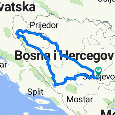 Giro di West Bosnia
- Distance
- 797.6 km
- Ascent
- 19,774 m
- Descent
- 19,773 m
- Location
- Sarajevo, Federation of Bosnia and Herzegovina, Bosnia and Herzegovina
 Sarajevo - Mostar 5 dan 2008
- Distance
- 120.5 km
- Ascent
- 607 m
- Descent
- 1,048 m
- Location
- Sarajevo, Federation of Bosnia and Herzegovina, Bosnia and Herzegovina
 vrelo Bosne
- Distance
- 7.1 km
- Ascent
- 102 m
- Descent
- 57 m
- Location
- Sarajevo, Federation of Bosnia and Herzegovina, Bosnia and Herzegovina
Open it in the app