

2018 - Découverte de la Camargue
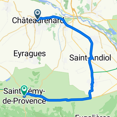
A cycling route starting in Châteaurenard, Provence-Alpes-Côte d'Azur Region, France.
Overview
About this route
Route taken from March 30 to April 2, 2018
Stages:
Mas-Thibert | 85 km
Saintes-Maries | 70 km
Saint-Gilles | 85 km
Châteaurenard | 60 km
- -:--
- Duration
- 277 km
- Distance
- 173 m
- Ascent
- 173 m
- Descent
- ---
- Avg. speed
- 50 m
- Max. altitude
Route quality
Waytypes & surfaces along the route
Waytypes
Road
66.5 km
(24 %)
Cycleway
63.7 km
(23 %)
Surfaces
Paved
199.5 km
(72 %)
Unpaved
38.8 km
(14 %)
Asphalt
191.1 km
(69 %)
Gravel
19.4 km
(7 %)
Continue with Bikemap
Use, edit, or download this cycling route
You would like to ride 2018 - Découverte de la Camargue or customize it for your own trip? Here is what you can do with this Bikemap route:
Free features
- Save this route as favorite or in collections
- Copy & plan your own version of this route
- Split it into stages to create a multi-day tour
- Sync your route with Garmin or Wahoo
Premium features
Free trial for 3 days, or one-time payment. More about Bikemap Premium.
- Navigate this route on iOS & Android
- Export a GPX / KML file of this route
- Create your custom printout (try it for free)
- Download this route for offline navigation
Discover more Premium features.
Get Bikemap PremiumFrom our community
Other popular routes starting in Châteaurenard
 De Chemin des Lonnes 323, Châteaurenard à Chemin des Lonnes 323, Châteaurenard
- Distance
- 79 km
- Ascent
- 269 m
- Descent
- 319 m
- Location
- Châteaurenard, Provence-Alpes-Côte d'Azur Region, France
 De Chemin des Lonnes 323, Châteaurenard à Route de Tarascon 314, Châteaurenard
- Distance
- 81.9 km
- Ascent
- 701 m
- Descent
- 755 m
- Location
- Châteaurenard, Provence-Alpes-Côte d'Azur Region, France
 Rue Jentelin, Châteaurenard naar Boulevard Marceau, Saint-Rémy-de-Provence
- Distance
- 28 km
- Ascent
- 50 m
- Descent
- 26 m
- Location
- Châteaurenard, Provence-Alpes-Côte d'Azur Region, France
 2017 - Traversée des Alpes
- Distance
- 1,155.6 km
- Ascent
- 24,746 m
- Descent
- 24,413 m
- Location
- Châteaurenard, Provence-Alpes-Côte d'Azur Region, France
 De Chemin des Lonnes 323, Châteaurenard à Chemin des Lonnes 323, Châteaurenard
- Distance
- 56.3 km
- Ascent
- 597 m
- Descent
- 608 m
- Location
- Châteaurenard, Provence-Alpes-Côte d'Azur Region, France
 De Chemin des Lonnes 323, Châteaurenard à Chemin des Lonnes 323, Châteaurenard
- Distance
- 73.1 km
- Ascent
- 499 m
- Descent
- 553 m
- Location
- Châteaurenard, Provence-Alpes-Côte d'Azur Region, France
 De Chemin des Lonnes 323, Châteaurenard à Chemin des Lonnes 323, Châteaurenard
- Distance
- 62.8 km
- Ascent
- 760 m
- Descent
- 811 m
- Location
- Châteaurenard, Provence-Alpes-Côte d'Azur Region, France
 De Chemin des Lonnes 323, Châteaurenard à Route de Tarascon 314, Châteaurenard
- Distance
- 61.4 km
- Ascent
- 149 m
- Descent
- 202 m
- Location
- Châteaurenard, Provence-Alpes-Côte d'Azur Region, France
Open it in the app