
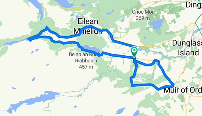
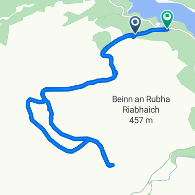
Marybank - Loch Achilty - Muir of Ord
A cycling route starting in Muir of Ord, Scotland, United Kingdom.
Overview
About this route
- -:--
- Duration
- 40.2 km
- Distance
- 412 m
- Ascent
- 410 m
- Descent
- ---
- Avg. speed
- 114 m
- Avg. speed
Route quality
Waytypes & surfaces along the route
Waytypes
Quiet road
18.8 km
(47 %)
Road
12.1 km
(30 %)
Surfaces
Paved
9.4 km
(23 %)
Asphalt
8.9 km
(22 %)
Paved (undefined)
0.5 km
(1 %)
Undefined
30.7 km
(77 %)
Continue with Bikemap
Use, edit, or download this cycling route
You would like to ride Marybank - Loch Achilty - Muir of Ord or customize it for your own trip? Here is what you can do with this Bikemap route:
Free features
- Save this route as favorite or in collections
- Copy & plan your own version of this route
- Sync your route with Garmin or Wahoo
Premium features
Free trial for 3 days, or one-time payment. More about Bikemap Premium.
- Navigate this route on iOS & Android
- Export a GPX / KML file of this route
- Create your custom printout (try it for free)
- Download this route for offline navigation
Discover more Premium features.
Get Bikemap PremiumFrom our community
Other popular routes starting in Muir of Ord
 4525454
- Distance
- 28.9 km
- Ascent
- 336 m
- Descent
- 321 m
- Location
- Muir of Ord, Scotland, United Kingdom
 Unnamed Road to Co-Op Station Road
- Distance
- 9.4 km
- Ascent
- 3 m
- Descent
- 46 m
- Location
- Muir of Ord, Scotland, United Kingdom
 Marybank orrin hydro
- Distance
- 32.2 km
- Ascent
- 441 m
- Descent
- 440 m
- Location
- Muir of Ord, Scotland, United Kingdom
 Marybank
- Distance
- 24.4 km
- Ascent
- 386 m
- Descent
- 450 m
- Location
- Muir of Ord, Scotland, United Kingdom
 JOGLE AB day 3 71 miles
- Distance
- 114 km
- Ascent
- 403 m
- Descent
- 377 m
- Location
- Muir of Ord, Scotland, United Kingdom
 Grianan, Hawthorn Road, Muir Of Ord to Aird and Loch Ness Ward, Muir Of Ord
- Distance
- 8.7 km
- Ascent
- 300 m
- Descent
- 42 m
- Location
- Muir of Ord, Scotland, United Kingdom
 Recording from 27 June 2:51 pm
- Distance
- 13.7 km
- Ascent
- 329 m
- Descent
- 382 m
- Location
- Muir of Ord, Scotland, United Kingdom
 Route from A862, Muir of Ord
- Distance
- 5.3 km
- Ascent
- 27 m
- Descent
- 22 m
- Location
- Muir of Ord, Scotland, United Kingdom
Open it in the app