

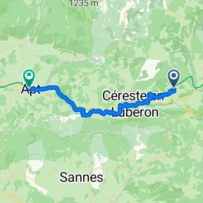
24-16a Reillanne - Mirabeau
A cycling route starting in Reillanne, Provence-Alpes-Côte d'Azur Region, France.
Overview
About this route
- -:--
- Duration
- 40.4 km
- Distance
- 694 m
- Ascent
- 871 m
- Descent
- ---
- Avg. speed
- 659 m
- Max. altitude

Route quality
Waytypes & surfaces along the route
Waytypes
Road
20.6 km
(51 %)
Quiet road
6.5 km
(16 %)
Surfaces
Paved
31.5 km
(78 %)
Asphalt
31.5 km
(78 %)
Undefined
8.9 km
(22 %)
Continue with Bikemap
Use, edit, or download this cycling route
You would like to ride 24-16a Reillanne - Mirabeau or customize it for your own trip? Here is what you can do with this Bikemap route:
Free features
- Save this route as favorite or in collections
- Copy & plan your own version of this route
- Sync your route with Garmin or Wahoo
Premium features
Free trial for 3 days, or one-time payment. More about Bikemap Premium.
- Navigate this route on iOS & Android
- Export a GPX / KML file of this route
- Create your custom printout (try it for free)
- Download this route for offline navigation
Discover more Premium features.
Get Bikemap PremiumFrom our community
Other popular routes starting in Reillanne
 Reillanne - Apt
- Distance
- 31.5 km
- Ascent
- 277 m
- Descent
- 590 m
- Location
- Reillanne, Provence-Alpes-Côte d'Azur Region, France
 Descente sur toulon
- Distance
- 170.7 km
- Ascent
- 1,173 m
- Descent
- 1,779 m
- Location
- Reillanne, Provence-Alpes-Côte d'Azur Region, France
 24-16a Reillanne - Mirabeau
- Distance
- 40.4 km
- Ascent
- 694 m
- Descent
- 871 m
- Location
- Reillanne, Provence-Alpes-Côte d'Azur Region, France
 Simiane-La-Rotonde - Rustrel - Oppedete - Manosque
- Distance
- 73.3 km
- Ascent
- 1,009 m
- Descent
- 1,312 m
- Location
- Reillanne, Provence-Alpes-Côte d'Azur Region, France
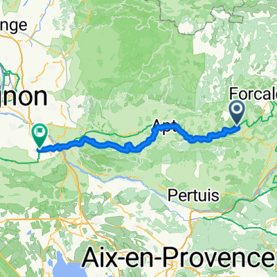
 24-16b Reillanne - Mirabeau
- Distance
- 74 km
- Ascent
- 699 m
- Descent
- 879 m
- Location
- Reillanne, Provence-Alpes-Côte d'Azur Region, France
 Dia 4 - Gite de Chaloux a Domain Saint Victor
- Distance
- 52.8 km
- Ascent
- 701 m
- Descent
- 997 m
- Location
- Reillanne, Provence-Alpes-Côte d'Azur Region, France
 Trasa C – kaňonem Oppedette do Manosque
- Distance
- 53.4 km
- Ascent
- 886 m
- Descent
- 1,226 m
- Location
- Reillanne, Provence-Alpes-Côte d'Azur Region, France
 Reillanne - Mollégès
- Distance
- 85.1 km
- Ascent
- 1,187 m
- Descent
- 1,685 m
- Location
- Reillanne, Provence-Alpes-Côte d'Azur Region, France
Open it in the app