

03.10.2024
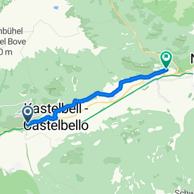
A cycling route starting in Castelbello-Ciardes - Kastelbell-Tschars, Trentino-Alto Adige, Italy.
Overview
About this route
- -:--
- Duration
- 27.4 km
- Distance
- 148 m
- Ascent
- 396 m
- Descent
- ---
- Avg. speed
- 579 m
- Max. altitude

Route quality
Waytypes & surfaces along the route
Waytypes
Cycleway
13.4 km
(49 %)
Quiet road
9.6 km
(35 %)
Surfaces
Paved
24.1 km
(88 %)
Unpaved
0.3 km
(1 %)
Asphalt
24.1 km
(88 %)
Ground
0.3 km
(1 %)
Undefined
3 km
(11 %)
Continue with Bikemap
Use, edit, or download this cycling route
You would like to ride 03.10.2024 or customize it for your own trip? Here is what you can do with this Bikemap route:
Free features
- Save this route as favorite or in collections
- Copy & plan your own version of this route
- Sync your route with Garmin or Wahoo
Premium features
Free trial for 3 days, or one-time payment. More about Bikemap Premium.
- Navigate this route on iOS & Android
- Export a GPX / KML file of this route
- Create your custom printout (try it for free)
- Download this route for offline navigation
Discover more Premium features.
Get Bikemap PremiumFrom our community
Other popular routes starting in Castelbello-Ciardes - Kastelbell-Tschars
 Haus bis Lana
- Distance
- 29 km
- Ascent
- 60 m
- Descent
- 355 m
- Location
- Castelbello-Ciardes - Kastelbell-Tschars, Trentino-Alto Adige, Italy
 via_vinum_venostis_179644104
- Distance
- 8.2 km
- Ascent
- 312 m
- Descent
- 216 m
- Location
- Castelbello-Ciardes - Kastelbell-Tschars, Trentino-Alto Adige, Italy
 Alpencross 2013 - Tag 5 - 06.09.2013
- Distance
- 57.9 km
- Ascent
- 2,094 m
- Descent
- 1,597 m
- Location
- Castelbello-Ciardes - Kastelbell-Tschars, Trentino-Alto Adige, Italy
 Radwandern Tschars-Naturns
- Distance
- 10.7 km
- Ascent
- 146 m
- Descent
- 172 m
- Location
- Castelbello-Ciardes - Kastelbell-Tschars, Trentino-Alto Adige, Italy
 Mals im Vinschgau
- Distance
- 75.5 km
- Ascent
- 813 m
- Descent
- 799 m
- Location
- Castelbello-Ciardes - Kastelbell-Tschars, Trentino-Alto Adige, Italy
 Kastelbach_Freeridestrecke
- Distance
- 29.9 km
- Ascent
- 1,248 m
- Descent
- 1,249 m
- Location
- Castelbello-Ciardes - Kastelbell-Tschars, Trentino-Alto Adige, Italy
 Vin - höhe
- Distance
- 67.7 km
- Ascent
- 1,127 m
- Descent
- 1,090 m
- Location
- Castelbello-Ciardes - Kastelbell-Tschars, Trentino-Alto Adige, Italy
 Etschradweg
- Distance
- 102 km
- Ascent
- 73 m
- Descent
- 512 m
- Location
- Castelbello-Ciardes - Kastelbell-Tschars, Trentino-Alto Adige, Italy
Open it in the app