

Mouans Sartoux rit 1
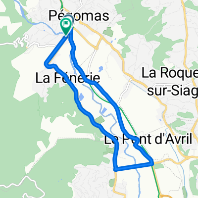
A cycling route starting in Pégomas, Provence-Alpes-Côte d'Azur Region, France.
Overview
About this route
- -:--
- Duration
- 94.5 km
- Distance
- 2,052 m
- Ascent
- 2,037 m
- Descent
- ---
- Avg. speed
- 994 m
- Max. altitude

Route quality
Waytypes & surfaces along the route
Waytypes
Quiet road
17 km
(18 %)
Road
12.3 km
(13 %)
Surfaces
Paved
49.2 km
(52 %)
Unpaved
0.9 km
(1 %)
Asphalt
49.2 km
(52 %)
Loose gravel
0.9 km
(1 %)
Undefined
44.4 km
(47 %)
Continue with Bikemap
Use, edit, or download this cycling route
You would like to ride Mouans Sartoux rit 1 or customize it for your own trip? Here is what you can do with this Bikemap route:
Free features
- Save this route as favorite or in collections
- Copy & plan your own version of this route
- Split it into stages to create a multi-day tour
- Sync your route with Garmin or Wahoo
Premium features
Free trial for 3 days, or one-time payment. More about Bikemap Premium.
- Navigate this route on iOS & Android
- Export a GPX / KML file of this route
- Create your custom printout (try it for free)
- Download this route for offline navigation
Discover more Premium features.
Get Bikemap PremiumFrom our community
Other popular routes starting in Pégomas
 Mouans Sartoux rit 1
- Distance
- 94.5 km
- Ascent
- 2,052 m
- Descent
- 2,037 m
- Location
- Pégomas, Provence-Alpes-Côte d'Azur Region, France
 2205_Jour_13
- Distance
- 78.9 km
- Ascent
- 1,458 m
- Descent
- 1,314 m
- Location
- Pégomas, Provence-Alpes-Côte d'Azur Region, France
 vtt cannes
- Distance
- 2.4 km
- Ascent
- 291 m
- Descent
- 46 m
- Location
- Pégomas, Provence-Alpes-Côte d'Azur Region, France
 123 Chemin de la Tuilière, Pégomas to 730 Avenue du Docteur Julien Lefebvre, Villeneuve-Loubet
- Distance
- 36.6 km
- Ascent
- 247 m
- Descent
- 297 m
- Location
- Pégomas, Provence-Alpes-Côte d'Azur Region, France
 pegomas- theoule Agay- Esterel- mandelieu- Pegomas
- Distance
- 72.2 km
- Ascent
- 596 m
- Descent
- 597 m
- Location
- Pégomas, Provence-Alpes-Côte d'Azur Region, France
 etappe 7
- Distance
- 50.8 km
- Ascent
- 859 m
- Descent
- 406 m
- Location
- Pégomas, Provence-Alpes-Côte d'Azur Region, France
 Pegomas bar sur loup Bramafan St Pons col de vence Vence
- Distance
- 50.2 km
- Ascent
- 1,445 m
- Descent
- 1,147 m
- Location
- Pégomas, Provence-Alpes-Côte d'Azur Region, France
 circuit course 20 mars 2011
- Distance
- 7.7 km
- Ascent
- 103 m
- Descent
- 104 m
- Location
- Pégomas, Provence-Alpes-Côte d'Azur Region, France
Open it in the app