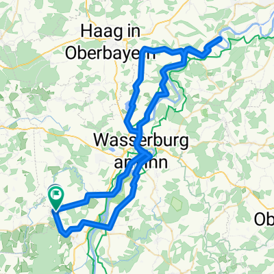
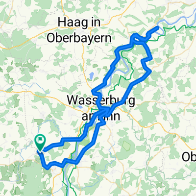
Trainigstour 28-03-2009
A cycling route starting in Ramerberg, Bavaria, Germany.
Overview
About this route
- -:--
- Duration
- 59.8 km
- Distance
- 434 m
- Ascent
- 439 m
- Descent
- ---
- Avg. speed
- 583 m
- Avg. speed
Route quality
Waytypes & surfaces along the route
Waytypes
Quiet road
33.3 km
(56 %)
Busy road
14.7 km
(25 %)
Surfaces
Paved
56.5 km
(94 %)
Unpaved
0.6 km
(1 %)
Asphalt
56.5 km
(94 %)
Gravel
0.5 km
(<1 %)
Continue with Bikemap
Use, edit, or download this cycling route
You would like to ride Trainigstour 28-03-2009 or customize it for your own trip? Here is what you can do with this Bikemap route:
Free features
- Save this route as favorite or in collections
- Copy & plan your own version of this route
- Sync your route with Garmin or Wahoo
Premium features
Free trial for 3 days, or one-time payment. More about Bikemap Premium.
- Navigate this route on iOS & Android
- Export a GPX / KML file of this route
- Create your custom printout (try it for free)
- Download this route for offline navigation
Discover more Premium features.
Get Bikemap PremiumFrom our community
Other popular routes starting in Ramerberg
- Am Bach 3, Ramerberg nach Via Dono Doni 18, Assisi
- Distance
- 973.6 km
- Ascent
- 10,434 m
- Descent
- 10,482 m
- Location
- Ramerberg, Bavaria, Germany
- Irschenberg
- Distance
- 72.1 km
- Ascent
- 462 m
- Descent
- 451 m
- Location
- Ramerberg, Bavaria, Germany
- GraphHopper Track
- Distance
- 731.5 km
- Ascent
- 822 m
- Descent
- 1,251 m
- Location
- Ramerberg, Bavaria, Germany
- Wasserburger Radrundweg
- Distance
- 107.9 km
- Ascent
- 1,016 m
- Descent
- 1,016 m
- Location
- Ramerberg, Bavaria, Germany
- Trainigstour 28-03-2009 CLONED FROM ROUTE 139427
- Distance
- 59.9 km
- Ascent
- 311 m
- Descent
- 311 m
- Location
- Ramerberg, Bavaria, Germany
- Ramerberg - Rosapineta
- Distance
- 527.2 km
- Ascent
- 1,707 m
- Descent
- 2,181 m
- Location
- Ramerberg, Bavaria, Germany
- Ramerberg - Caldonazzosee
- Distance
- 335 km
- Ascent
- 1,249 m
- Descent
- 1,258 m
- Location
- Ramerberg, Bavaria, Germany
- Saint-Jean-Pied-de-Port
- Distance
- 1,709.2 km
- Ascent
- 9,294 m
- Descent
- 9,588 m
- Location
- Ramerberg, Bavaria, Germany
Open it in the app