

Rövid hegymenet a Törökvészen
A cycling route starting in Budapest I. kerület, Budapest, Hungary.
Overview
About this route
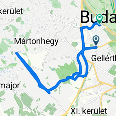
Passable on a fully paved surface. The first half is flat, but from the Mechwart park it rises continuously. There are gentler sections, but there are no steep parts.
- -:--
- Duration
- 7.7 km
- Distance
- 210 m
- Ascent
- 75 m
- Descent
- ---
- Avg. speed
- ---
- Max. altitude
Route quality
Waytypes & surfaces along the route
Waytypes
Road
5.5 km
(71 %)
Quiet road
0.8 km
(10 %)
Surfaces
Paved
7.6 km
(98 %)
Asphalt
7.6 km
(98 %)
Undefined
0.2 km
(2 %)
Route highlights
Points of interest along the route
Point of interest after 2.4 km
Continue with Bikemap
Use, edit, or download this cycling route
You would like to ride Rövid hegymenet a Törökvészen or customize it for your own trip? Here is what you can do with this Bikemap route:
Free features
- Save this route as favorite or in collections
- Copy & plan your own version of this route
- Sync your route with Garmin or Wahoo
Premium features
Free trial for 3 days, or one-time payment. More about Bikemap Premium.
- Navigate this route on iOS & Android
- Export a GPX / KML file of this route
- Create your custom printout (try it for free)
- Download this route for offline navigation
Discover more Premium features.
Get Bikemap PremiumFrom our community
Other popular routes starting in Budapest I. kerület
 Budapest to Prague
- Distance
- 870.9 km
- Ascent
- 1,191 m
- Descent
- 1,045 m
- Location
- Budapest I. kerület, Budapest, Hungary
 2014 - Budapest - Szentendre
- Distance
- 26.3 km
- Ascent
- 39 m
- Descent
- 46 m
- Location
- Budapest I. kerület, Budapest, Hungary
 Budapest-Dömsöd (Halastó) 2011.06.17. - Csepel-sziget
- Distance
- 56.2 km
- Ascent
- 36 m
- Descent
- 72 m
- Location
- Budapest I. kerület, Budapest, Hungary
 Budapest - Komarom
- Distance
- 118.2 km
- Ascent
- 117 m
- Descent
- 112 m
- Location
- Budapest I. kerület, Budapest, Hungary
 Budapeste - Szenres
- Distance
- 76.2 km
- Ascent
- 72 m
- Descent
- 40 m
- Location
- Budapest I. kerület, Budapest, Hungary
 The river route
- Distance
- 22.7 km
- Ascent
- 70 m
- Descent
- 87 m
- Location
- Budapest I. kerület, Budapest, Hungary
 Mészáros utca - Naphegy utca
- Distance
- 12.9 km
- Ascent
- 160 m
- Descent
- 223 m
- Location
- Budapest I. kerület, Budapest, Hungary
 Csepel - Dél Buda
- Distance
- 42.8 km
- Ascent
- 209 m
- Descent
- 198 m
- Location
- Budapest I. kerület, Budapest, Hungary
Open it in the app