
【常陸太田市】豊かな自然を巡るコース
20231101_【常陸太田市】豊かな自然を巡るコース
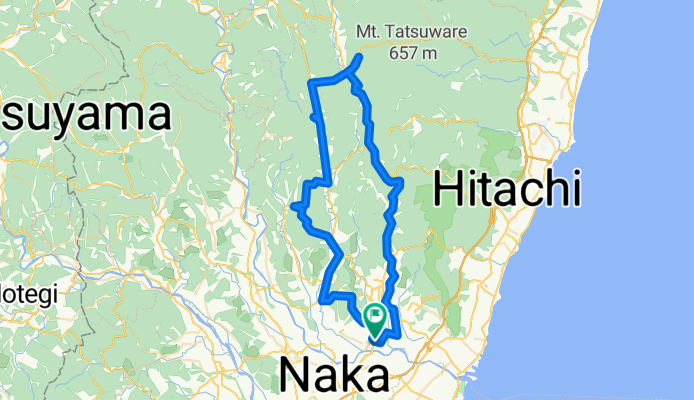
A cycling route starting in Funaishikawa, Ibaraki, Japan.
Overview
About this route
STRAVA 75.64 km +1,362 m
Download the official map of the Okukuji Satoyama Hill Climb route
- 33 h 4 min
- Duration
- 75.7 km
- Distance
- 1,245 m
- Ascent
- 1,247 m
- Descent
- 2.3 km/h
- Avg. speed
- 318 m
- Max. altitude

Part of
【常陸太田市】豊かな自然を巡るコース
1 stage
Route photos


Route quality
Waytypes & surfaces along the route
Waytypes
Quiet road
31 km
(41 %)
Cycleway
12.9 km
(17 %)
Surfaces
Paved
42.4 km
(56 %)
Asphalt
24.2 km
(32 %)
Paved (undefined)
18.2 km
(24 %)
Undefined
33.3 km
(44 %)
Route highlights
Points of interest along the route
Point of interest after 0 km
道の駅ひたちおおた
Point of interest after 14.2 km
旧町屋変電所
Point of interest after 14.2 km
トイレ
Point of interest after 29.3 km
道の駅さとみ
Point of interest after 32.8 km
横川の下滝
Point of interest after 32.8 km
花貫渓谷
Point of interest after 43 km
竜神大吊橋
Point of interest after 55.1 km
金砂ふるさと体験交流施設 かなさ笑楽校
Point of interest after 70.1 km
西山荘
Point of interest after 73.3 km
太田温泉やまぶきの湯
Continue with Bikemap
Use, edit, or download this cycling route
You would like to ride 20231101_【常陸太田市】豊かな自然を巡るコース or customize it for your own trip? Here is what you can do with this Bikemap route:
Free features
- Save this route as favorite or in collections
- Copy & plan your own version of this route
- Sync your route with Garmin or Wahoo
Premium features
Free trial for 3 days, or one-time payment. More about Bikemap Premium.
- Navigate this route on iOS & Android
- Export a GPX / KML file of this route
- Create your custom printout (try it for free)
- Download this route for offline navigation
Discover more Premium features.
Get Bikemap PremiumFrom our community
Other popular routes starting in Funaishikawa
 20231101_【常陸太田市】豊かな自然を巡るコース
- Distance
- 75.7 km
- Ascent
- 1,245 m
- Descent
- 1,247 m
- Location
- Funaishikawa, Ibaraki, Japan
 那珂川サイクリングロード
- Distance
- 52.8 km
- Ascent
- 184 m
- Descent
- 227 m
- Location
- Funaishikawa, Ibaraki, Japan
Open it in the app