

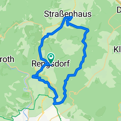
Rengsd-Wasserturm Kurtsch-Teufelstreppe-Fockenbach 24km 350 Hm
A cycling route starting in Rengsdorf, Rhineland-Palatinate, Germany.
Overview
About this route
Start: Rengsdorf Tennisplatz, Ehlscheid, Talhof, Kurtscheid, Abstecher zur Aussichtsplattform auf dem Wasserturm, Birkenhof, Waldstrecke zum Heiligenstock und Abstecher zur Teufelstreppe (Stangenstein), Waldstrecke zur Burschenhütte am Fockenbach, Höllsbach, Niederhonnefeld, Naturschwimbad, Ellingen, Oberhonnefeld, Biotop Höllsbach, Straßenhaus, Jahrsfelder Weg, Bonefeld, Deichwiesenhof, Rengsdorf, Einkehr in der Tennisterrasse
- -:--
- Duration
- 24.2 km
- Distance
- 428 m
- Ascent
- 435 m
- Descent
- ---
- Avg. speed
- 403 m
- Avg. speed
Route quality
Waytypes & surfaces along the route
Waytypes
Track
8.4 km
(35 %)
Quiet road
5.3 km
(22 %)
Surfaces
Paved
14.9 km
(62 %)
Unpaved
3.7 km
(15 %)
Asphalt
13.8 km
(57 %)
Loose gravel
1.5 km
(6 %)
Continue with Bikemap
Use, edit, or download this cycling route
You would like to ride Rengsd-Wasserturm Kurtsch-Teufelstreppe-Fockenbach 24km 350 Hm or customize it for your own trip? Here is what you can do with this Bikemap route:
Free features
- Save this route as favorite or in collections
- Copy & plan your own version of this route
- Sync your route with Garmin or Wahoo
Premium features
Free trial for 3 days, or one-time payment. More about Bikemap Premium.
- Navigate this route on iOS & Android
- Export a GPX / KML file of this route
- Create your custom printout (try it for free)
- Download this route for offline navigation
Discover more Premium features.
Get Bikemap PremiumFrom our community
Other popular routes starting in Rengsdorf
 8-RWW-MTB-Tour
- Distance
- 34.5 km
- Ascent
- 494 m
- Descent
- 494 m
- Location
- Rengsdorf, Rhineland-Palatinate, Germany
 Rund um Rengsdorf
- Distance
- 24.4 km
- Ascent
- 352 m
- Descent
- 352 m
- Location
- Rengsdorf, Rhineland-Palatinate, Germany
 Rengsd-Völkerwiesenbach-Hardert-Aubach-Gierenderhöhe 25km
- Distance
- 24.7 km
- Ascent
- 361 m
- Descent
- 359 m
- Location
- Rengsdorf, Rhineland-Palatinate, Germany
 Rengsdorf-Wiedbachtal-Rengsdorf
- Distance
- 40.7 km
- Ascent
- 572 m
- Descent
- 577 m
- Location
- Rengsdorf, Rhineland-Palatinate, Germany
 Rengsd-Wasserturm Kurtsch-Teufelstreppe-Fockenbach 24km 350 Hm
- Distance
- 24.2 km
- Ascent
- 428 m
- Descent
- 435 m
- Location
- Rengsdorf, Rhineland-Palatinate, Germany
 Rengsdorf-Urbach-Runde 32 km
- Distance
- 32 km
- Ascent
- 432 m
- Descent
- 431 m
- Location
- Rengsdorf, Rhineland-Palatinate, Germany
 Waldstraße 5, Rengsdorf nach Waldstraße 3, Rengsdorf
- Distance
- 23.7 km
- Ascent
- 516 m
- Descent
- 513 m
- Location
- Rengsdorf, Rhineland-Palatinate, Germany
 Kleine Rengsdorfer Runde
- Distance
- 30.6 km
- Ascent
- 545 m
- Descent
- 581 m
- Location
- Rengsdorf, Rhineland-Palatinate, Germany
Open it in the app