

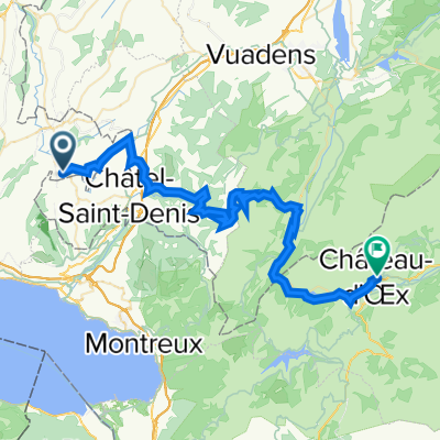
Palézieux
A cycling route starting in Palézieux, Canton of Vaud, Switzerland.
Overview
About this route
- 11 h 7 min
- Duration
- 171.6 km
- Distance
- 1,642 m
- Ascent
- 1,956 m
- Descent
- 15.4 km/h
- Avg. speed
- 742 m
- Max. altitude
Route quality
Waytypes & surfaces along the route
Waytypes
Quiet road
53.2 km
(31 %)
Road
34.3 km
(20 %)
Surfaces
Paved
96.1 km
(56 %)
Unpaved
6.9 km
(4 %)
Asphalt
72.1 km
(42 %)
Paved (undefined)
15.4 km
(9 %)
Continue with Bikemap
Use, edit, or download this cycling route
You would like to ride Palézieux or customize it for your own trip? Here is what you can do with this Bikemap route:
Free features
- Save this route as favorite or in collections
- Copy & plan your own version of this route
- Split it into stages to create a multi-day tour
- Sync your route with Garmin or Wahoo
Premium features
Free trial for 3 days, or one-time payment. More about Bikemap Premium.
- Navigate this route on iOS & Android
- Export a GPX / KML file of this route
- Create your custom printout (try it for free)
- Download this route for offline navigation
Discover more Premium features.
Get Bikemap PremiumFrom our community
Other popular routes starting in Palézieux
 Palézieux
- Distance
- 6.6 km
- Ascent
- 182 m
- Descent
- 95 m
- Location
- Palézieux, Canton of Vaud, Switzerland
 Lausanne/Thun/Biel/Jura/Marchairuz/Lausanne
- Distance
- 483.2 km
- Ascent
- 8,014 m
- Descent
- 8,264 m
- Location
- Palézieux, Canton of Vaud, Switzerland
 Wysam 333 Boucle FR
- Distance
- 108.8 km
- Ascent
- 732 m
- Descent
- 732 m
- Location
- Palézieux, Canton of Vaud, Switzerland
 Slow ride
- Distance
- 25.8 km
- Ascent
- 368 m
- Descent
- 286 m
- Location
- Palézieux, Canton of Vaud, Switzerland
 Palézieux
- Distance
- 172 km
- Ascent
- 1,619 m
- Descent
- 1,933 m
- Location
- Palézieux, Canton of Vaud, Switzerland
 Attalens-Vevey
- Distance
- 17.3 km
- Ascent
- 353 m
- Descent
- 706 m
- Location
- Palézieux, Canton of Vaud, Switzerland
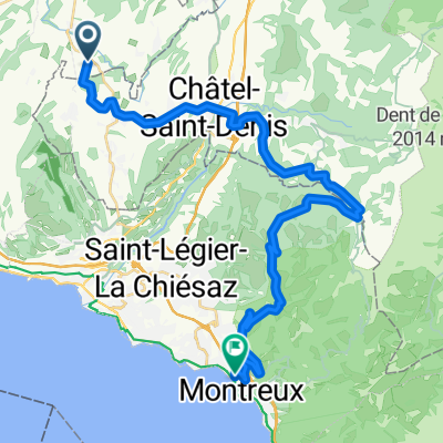
 Palézieux-Gare - Col de Belle Chaux - Albeuve - Château-d'Oex
- Distance
- 48.6 km
- Ascent
- 1,542 m
- Descent
- 1,251 m
- Location
- Palézieux, Canton of Vaud, Switzerland
 Palézieux-Châtel-Paccots-Chamby-Montreux
- Distance
- 32.6 km
- Ascent
- 647 m
- Descent
- 915 m
- Location
- Palézieux, Canton of Vaud, Switzerland
Open it in the app