

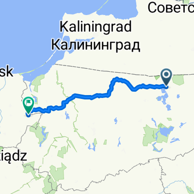
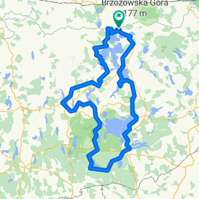
Wyprawa 2024 - Dzień 4
A cycling route starting in Węgorzewo, Warmian-Masurian Voivodeship, Poland.
Overview
About this route
- -:--
- Duration
- 147.8 km
- Distance
- 978 m
- Ascent
- 931 m
- Descent
- ---
- Avg. speed
- 271 m
- Max. altitude

Route quality
Waytypes & surfaces along the route
Waytypes
Quiet road
76.8 km
(52 %)
Road
29.6 km
(20 %)
Surfaces
Paved
69.5 km
(47 %)
Unpaved
68 km
(46 %)
Asphalt
69.5 km
(47 %)
Gravel
54.7 km
(37 %)
Route highlights
Points of interest along the route
Point of interest after 47.9 km
Zajazd Piękna Góra
Point of interest after 51.6 km
Wieża Ciśnień w Gołdapi
Point of interest after 85.5 km
Wieża widokowa w Stańczykach
Point of interest after 86.4 km
Mosty w Stańczykach
Point of interest after 94.5 km
Wieża widokowa w Pobłędziu
Point of interest after 102.9 km
Wisztyniec - Trójstyk granic
Point of interest after 124 km
Punkt widokowy - Turtul
Point of interest after 146.7 km
Plac Konstytucji 3 Maja
Point of interest after 147.6 km
Plac Marii Konopnickiej
Continue with Bikemap
Use, edit, or download this cycling route
You would like to ride Wyprawa 2024 - Dzień 4 or customize it for your own trip? Here is what you can do with this Bikemap route:
Free features
- Save this route as favorite or in collections
- Copy & plan your own version of this route
- Split it into stages to create a multi-day tour
- Sync your route with Garmin or Wahoo
Premium features
Free trial for 3 days, or one-time payment. More about Bikemap Premium.
- Navigate this route on iOS & Android
- Export a GPX / KML file of this route
- Create your custom printout (try it for free)
- Download this route for offline navigation
Discover more Premium features.
Get Bikemap PremiumFrom our community
Other popular routes starting in Węgorzewo
 Słowackiego do Odrodzenia
- Distance
- 214.3 km
- Ascent
- 1,128 m
- Descent
- 1,232 m
- Location
- Węgorzewo, Warmian-Masurian Voivodeship, Poland
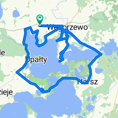
 pętla Węgorzewo
- Distance
- 95.6 km
- Ascent
- 514 m
- Descent
- 513 m
- Location
- Węgorzewo, Warmian-Masurian Voivodeship, Poland
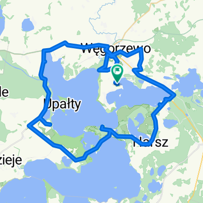
 pętla
pętla- Distance
- 76 km
- Ascent
- 335 m
- Descent
- 354 m
- Location
- Węgorzewo, Warmian-Masurian Voivodeship, Poland
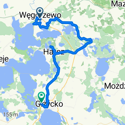 Juliusza Słowackiego, Węgorzewo do al Wojska Polskiego, Giżycko
- Distance
- 53.1 km
- Ascent
- 602 m
- Descent
- 601 m
- Location
- Węgorzewo, Warmian-Masurian Voivodeship, Poland
 Pętelka wokół Mamr
- Distance
- 56.5 km
- Ascent
- 111 m
- Descent
- 111 m
- Location
- Węgorzewo, Warmian-Masurian Voivodeship, Poland
 mazurska pętla
- Distance
- 285.9 km
- Ascent
- 1,709 m
- Descent
- 1,707 m
- Location
- Węgorzewo, Warmian-Masurian Voivodeship, Poland
 Wyprawa 2024 - Dzień 4
- Distance
- 147.8 km
- Ascent
- 978 m
- Descent
- 931 m
- Location
- Węgorzewo, Warmian-Masurian Voivodeship, Poland
 do Giżycka
- Distance
- 33.1 km
- Ascent
- 141 m
- Descent
- 175 m
- Location
- Węgorzewo, Warmian-Masurian Voivodeship, Poland
Open it in the app