

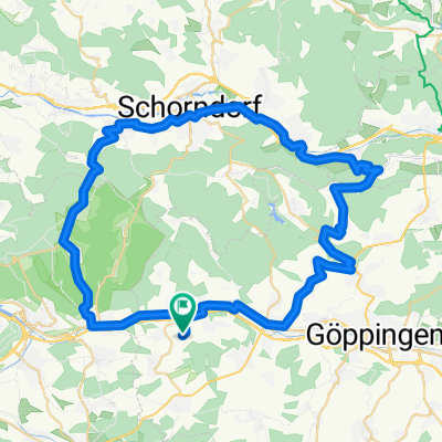
Sulpach-Hepsisau-Bad Urach-Dettingen/Erms-Kirchheim-Sulpach
A cycling route starting in Ebersbach an der Fils, Baden-Wurttemberg, Germany.
Overview
About this route
Project for 2009
Similar route description in Tour 04/2009
Gradient quotient 14.1 Hm/km
Reference: Alb Extrem 190 km = 14.7 Hm/km
- -:--
- Duration
- 98.4 km
- Distance
- 1,464 m
- Ascent
- 1,523 m
- Descent
- ---
- Avg. speed
- 822 m
- Max. altitude

Route quality
Waytypes & surfaces along the route
Waytypes
Road
24.6 km
(25 %)
Track
11.8 km
(12 %)
Surfaces
Paved
77.7 km
(79 %)
Unpaved
1 km
(1 %)
Asphalt
72.8 km
(74 %)
Paved (undefined)
3.9 km
(4 %)
Continue with Bikemap
Use, edit, or download this cycling route
You would like to ride Sulpach-Hepsisau-Bad Urach-Dettingen/Erms-Kirchheim-Sulpach or customize it for your own trip? Here is what you can do with this Bikemap route:
Free features
- Save this route as favorite or in collections
- Copy & plan your own version of this route
- Split it into stages to create a multi-day tour
- Sync your route with Garmin or Wahoo
Premium features
Free trial for 3 days, or one-time payment. More about Bikemap Premium.
- Navigate this route on iOS & Android
- Export a GPX / KML file of this route
- Create your custom printout (try it for free)
- Download this route for offline navigation
Discover more Premium features.
Get Bikemap PremiumFrom our community
Other popular routes starting in Ebersbach an der Fils
 Sulpach-Eselhöfe-Sulpach: Große Runde
- Distance
- 99.7 km
- Ascent
- 2,020 m
- Descent
- 1,980 m
- Location
- Ebersbach an der Fils, Baden-Wurttemberg, Germany
 Sulpach-Randecker Maar- Bad Urach-Falkensteiner Höhle- Deutsches Haus-Sulpach
- Distance
- 88.9 km
- Ascent
- 1,791 m
- Descent
- 1,735 m
- Location
- Ebersbach an der Fils, Baden-Wurttemberg, Germany
 Sulpach-Hepsisau-Randecker Maar-Gruibingen-Kirchheim-Plochingen
- Distance
- 77.1 km
- Ascent
- 1,038 m
- Descent
- 1,098 m
- Location
- Ebersbach an der Fils, Baden-Wurttemberg, Germany
 Sulpach-Täle-Neidlingen-Sulpach
- Distance
- 62.1 km
- Ascent
- 1,098 m
- Descent
- 1,078 m
- Location
- Ebersbach an der Fils, Baden-Wurttemberg, Germany
 Sulpach- Wendlingen-Nürtingen-Ötlingen-Hochdorf-Sulpach
- Distance
- 45.1 km
- Ascent
- 254 m
- Descent
- 288 m
- Location
- Ebersbach an der Fils, Baden-Wurttemberg, Germany
 Von Ebersbach an den Herrenbachstausee
- Distance
- 25.3 km
- Ascent
- 570 m
- Descent
- 479 m
- Location
- Ebersbach an der Fils, Baden-Wurttemberg, Germany
 Sulpach- Börtlingen-Waldhausen-Winterbach-Baltmannsweiler-Sulpach
- Distance
- 59.3 km
- Ascent
- 676 m
- Descent
- 664 m
- Location
- Ebersbach an der Fils, Baden-Wurttemberg, Germany
 Nasachtal Diegelsberg
- Distance
- 7.1 km
- Ascent
- 211 m
- Descent
- 211 m
- Location
- Ebersbach an der Fils, Baden-Wurttemberg, Germany
Open it in the app