

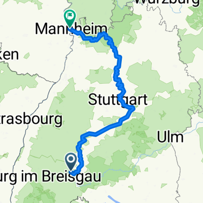
2017 - Neckartalweg
2017_03_27 Neckartalweg - Tag 1 - Villingen - Horb
A cycling route starting in Villingen-Schwenningen, Baden-Wurttemberg, Germany.
Overview
About this route
Neckartalweg - Day 1! - Villingen - Horb
- -:--
- Duration
- 86.8 km
- Distance
- 1,288 m
- Ascent
- 1,576 m
- Descent
- ---
- Avg. speed
- 766 m
- Max. altitude

Part of
2017 - Neckartalweg
4 stages
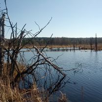
Route photos


Route quality
Waytypes & surfaces along the route
Waytypes
Track
30.4 km
(35 %)
Quiet road
26.9 km
(31 %)
Surfaces
Paved
69.5 km
(80 %)
Unpaved
9.6 km
(11 %)
Asphalt
63.4 km
(73 %)
Gravel
6.1 km
(7 %)
Continue with Bikemap
Use, edit, or download this cycling route
You would like to ride 2017_03_27 Neckartalweg - Tag 1 - Villingen - Horb or customize it for your own trip? Here is what you can do with this Bikemap route:
Free features
- Save this route as favorite or in collections
- Copy & plan your own version of this route
- Split it into stages to create a multi-day tour
- Sync your route with Garmin or Wahoo
Premium features
Free trial for 3 days, or one-time payment. More about Bikemap Premium.
- Navigate this route on iOS & Android
- Export a GPX / KML file of this route
- Create your custom printout (try it for free)
- Download this route for offline navigation
Discover more Premium features.
Get Bikemap PremiumFrom our community
Other popular routes starting in Villingen-Schwenningen
 Ausflug in den Schwarzwald
- Distance
- 63.7 km
- Ascent
- 787 m
- Descent
- 786 m
- Location
- Villingen-Schwenningen, Baden-Wurttemberg, Germany
 Mittlere Trainingstour
- Distance
- 21.7 km
- Ascent
- 291 m
- Descent
- 256 m
- Location
- Villingen-Schwenningen, Baden-Wurttemberg, Germany
 2017_03_27 Neckartalweg - Tag 1 - Villingen - Horb
- Distance
- 86.8 km
- Ascent
- 1,288 m
- Descent
- 1,576 m
- Location
- Villingen-Schwenningen, Baden-Wurttemberg, Germany
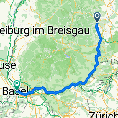 Bräunlingen nach Maulbeerstrasse, Basel
- Distance
- 140.1 km
- Ascent
- 1,218 m
- Descent
- 1,662 m
- Location
- Villingen-Schwenningen, Baden-Wurttemberg, Germany
 Neckartal-Radweg komplett
- Distance
- 354.5 km
- Ascent
- 1,095 m
- Descent
- 1,657 m
- Location
- Villingen-Schwenningen, Baden-Wurttemberg, Germany
 Neckartal-Radweg
- Distance
- 376.9 km
- Ascent
- 4,160 m
- Descent
- 4,771 m
- Location
- Villingen-Schwenningen, Baden-Wurttemberg, Germany
 Villingen - Balingen
- Distance
- 51.9 km
- Ascent
- 527 m
- Descent
- 720 m
- Location
- Villingen-Schwenningen, Baden-Wurttemberg, Germany
 Schöne Runde
- Distance
- 55.7 km
- Ascent
- 993 m
- Descent
- 992 m
- Location
- Villingen-Schwenningen, Baden-Wurttemberg, Germany
Open it in the app