

Krahulov - Kobylí hlava
A cycling route starting in Stařeč, Kraj Vysočina, Czechia.
Overview
About this route
Čím více zde napíšete informací, tím více bude užitečnější pro ostatním uživatele.<br /><br />* Průběh trasy.<br />* Co je zvláštní na této trase?<br />* Proč doporučit tuto trasu?<br />* Co se Vám zde nejvíce líbilo?<br />* Atd.
- -:--
- Duration
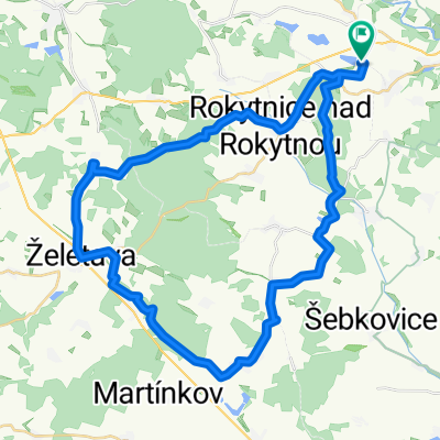
- 16.6 km
- Distance
- 229 m
- Ascent
- 229 m
- Descent
- ---
- Avg. speed
- ---
- Max. altitude

Continue with Bikemap
Use, edit, or download this cycling route
You would like to ride Krahulov - Kobylí hlava or customize it for your own trip? Here is what you can do with this Bikemap route:
Free features
- Save this route as favorite or in collections
- Copy & plan your own version of this route
- Sync your route with Garmin or Wahoo
Premium features
Free trial for 3 days, or one-time payment. More about Bikemap Premium.
- Navigate this route on iOS & Android
- Export a GPX / KML file of this route
- Create your custom printout (try it for free)
- Download this route for offline navigation
Discover more Premium features.
Get Bikemap PremiumFrom our community
Other popular routes starting in Stařeč
 Krahulov - Želetava přes Mařenku
- Distance
- 41.8 km
- Ascent
- 456 m
- Descent
- 456 m
- Location
- Stařeč, Kraj Vysočina, Czechia
 rudá stezka
- Distance
- 21.1 km
- Ascent
- 298 m
- Descent
- 286 m
- Location
- Stařeč, Kraj Vysočina, Czechia
 Stařeč - Slavice - Kojetice - Stařeč
- Distance
- 22.3 km
- Ascent
- 240 m
- Descent
- 241 m
- Location
- Stařeč, Kraj Vysočina, Czechia
 Řípov 49, Třebíč to Ve Bráně 47, Přibyslavice
- Distance
- 9.2 km
- Ascent
- 55 m
- Descent
- 105 m
- Location
- Stařeč, Kraj Vysočina, Czechia
 Stařeč, Krahulov, Steklák, Stařeč
- Distance
- 14.4 km
- Ascent
- 113 m
- Descent
- 113 m
- Location
- Stařeč, Kraj Vysočina, Czechia
 Za burčákem na Sádek
- Distance
- 25.9 km
- Ascent
- 358 m
- Descent
- 379 m
- Location
- Stařeč, Kraj Vysočina, Czechia
 stařeč - želetava - babice - sádek - stařeč
- Distance
- 42.3 km
- Ascent
- 568 m
- Descent
- 564 m
- Location
- Stařeč, Kraj Vysočina, Czechia
 Krahulov - Jihlava nádraží
- Distance
- 36.6 km
- Ascent
- 325 m
- Descent
- 307 m
- Location
- Stařeč, Kraj Vysočina, Czechia
Open it in the app