

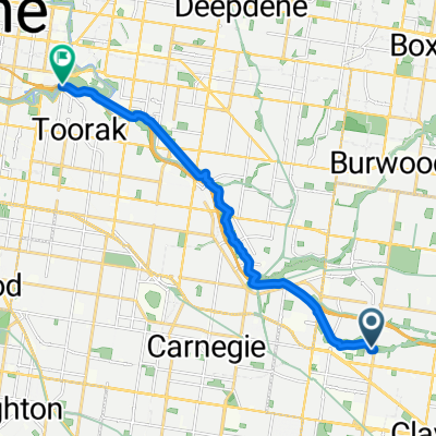
Eastlink 2 InfinityBK IN 13k
A cycling route starting in Chadstone, Victoria, Australia.
Overview
About this route
- -:--
- Duration
- 13.1 km
- Distance
- 59 m
- Ascent
- 40 m
- Descent
- ---
- Avg. speed
- 47 m
- Max. altitude

Route quality
Waytypes & surfaces along the route
Waytypes
Cycleway
8.8 km
(67 %)
Quiet road
3.3 km
(25 %)
Surfaces
Paved
10.4 km
(80 %)
Concrete
4.9 km
(38 %)
Asphalt
4 km
(30 %)
Continue with Bikemap
Use, edit, or download this cycling route
You would like to ride Eastlink 2 InfinityBK IN 13k or customize it for your own trip? Here is what you can do with this Bikemap route:
Free features
- Save this route as favorite or in collections
- Copy & plan your own version of this route
- Sync your route with Garmin or Wahoo
Premium features
Free trial for 3 days, or one-time payment. More about Bikemap Premium.
- Navigate this route on iOS & Android
- Export a GPX / KML file of this route
- Create your custom printout (try it for free)
- Download this route for offline navigation
Discover more Premium features.
Get Bikemap PremiumFrom our community
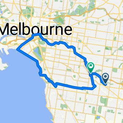
Other popular routes starting in Chadstone
 chaddy
- Distance
- 20.5 km
- Ascent
- 185 m
- Descent
- 177 m
- Location
- Chadstone, Victoria, Australia
 Scotchmans Creek Trail, Chadstone to Scotchmans Creek Trail, Glen Waverley
- Distance
- 7.1 km
- Ascent
- 73 m
- Descent
- 19 m
- Location
- Chadstone, Victoria, Australia
 Chadston to Home v1
- Distance
- 15.7 km
- Ascent
- 32 m
- Descent
- 72 m
- Location
- Chadstone, Victoria, Australia
 Stapley Crescent 29, Chadstone to Cabena Crescent 22, Chadstone
- Distance
- 47.6 km
- Ascent
- 337 m
- Descent
- 335 m
- Location
- Chadstone, Victoria, Australia
 Park Road 2, Chadstone to Park Road 2, Chadstone
- Distance
- 61.9 km
- Ascent
- 515 m
- Descent
- 523 m
- Location
- Chadstone, Victoria, Australia
 Tamar Grove 21, Oakleigh to Lewis Road 114, Wantirna South
- Distance
- 35.1 km
- Ascent
- 246 m
- Descent
- 227 m
- Location
- Chadstone, Victoria, Australia
 Recovered Route
- Distance
- 672.7 km
- Ascent
- 9 m
- Descent
- 68 m
- Location
- Chadstone, Victoria, Australia
 Scotchmans Creek Trail, Oakleigh to Scotchmans Creek Trail, Malvern East
- Distance
- 43.2 km
- Ascent
- 50 m
- Descent
- 80 m
- Location
- Chadstone, Victoria, Australia
Open it in the app