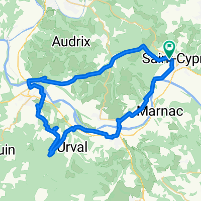
Castels noord
A cycling route starting in Saint-Cyprien, Aquitaine-Limousin-Poitou-Charentes, France.
Overview
About this route
Pernottamenti: Castels, Beynac-Cazenac, Sarlat, Thonac, Bardenat Punti d'interesse: Castello di Beynac, Grotte di Lascaux, Falesia calcarea di San Cristoforo, Castello de Commarque Fiume: La Dordogne, La Vézère, La Beune
- -:--
- Duration
- 76.2 km
- Distance
- 1,533 m
- Ascent
- 1,534 m
- Descent
- ---
- Avg. speed
- 298 m
- Avg. speed
Route quality
Waytypes & surfaces along the route
Waytypes
Quiet road
50.9 km
(67 %)
Busy road
15.1 km
(20 %)
Surfaces
Paved
51.1 km
(67 %)
Unpaved
0.8 km
(1 %)
Asphalt
51.1 km
(67 %)
Unpaved (undefined)
0.6 km
(<1 %)
Continue with Bikemap
Use, edit, or download this cycling route
You would like to ride Castels noord or customize it for your own trip? Here is what you can do with this Bikemap route:
Free features
- Save this route as favorite or in collections
- Copy & plan your own version of this route
- Sync your route with Garmin or Wahoo
Premium features
Free trial for 3 days, or one-time payment. More about Bikemap Premium.
- Navigate this route on iOS & Android
- Export a GPX / KML file of this route
- Create your custom printout (try it for free)
- Download this route for offline navigation
Discover more Premium features.
Get Bikemap PremiumFrom our community
Other popular routes starting in Saint-Cyprien
- Girolibero: Perigord
- Distance
- 252.8 km
- Ascent
- 1,021 m
- Descent
- 1,024 m
- Location
- Saint-Cyprien, Aquitaine-Limousin-Poitou-Charentes, France
- Perigord 4
- Distance
- 45 km
- Ascent
- 151 m
- Descent
- 265 m
- Location
- Saint-Cyprien, Aquitaine-Limousin-Poitou-Charentes, France
- Perigord 3
- Distance
- 52.2 km
- Ascent
- 501 m
- Descent
- 501 m
- Location
- Saint-Cyprien, Aquitaine-Limousin-Poitou-Charentes, France
- D: Saint-Vincent-de-Cosse - Margaux, 4.Etappe-Genf Bordeaux
- Distance
- 190.4 km
- Ascent
- 301 m
- Descent
- 379 m
- Location
- Saint-Cyprien, Aquitaine-Limousin-Poitou-Charentes, France
- Castang nach Sarlat
- Distance
- 59.2 km
- Ascent
- 575 m
- Descent
- 550 m
- Location
- Saint-Cyprien, Aquitaine-Limousin-Poitou-Charentes, France
- Girolibero: Perigord per famiglie
- Distance
- 75.5 km
- Ascent
- 1,020 m
- Descent
- 979 m
- Location
- Saint-Cyprien, Aquitaine-Limousin-Poitou-Charentes, France
- Castels noord
- Distance
- 76.2 km
- Ascent
- 1,533 m
- Descent
- 1,534 m
- Location
- Saint-Cyprien, Aquitaine-Limousin-Poitou-Charentes, France
- Rondje zonder Lars
- Distance
- 40.3 km
- Ascent
- 511 m
- Descent
- 528 m
- Location
- Saint-Cyprien, Aquitaine-Limousin-Poitou-Charentes, France
Open it in the app