

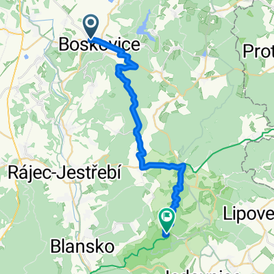
Němčice - Letovice - Sýkoř - Lomnice - Rájec - Němčice
A cycling route starting in Boskovice, South Moravian, Czechia.
Overview
About this route
- A fairly challenging hilly route (total ascent according to the cyclometer - approx. 1800 m)
- Several climbs on the route corresponding to categories 2, 3, and 4 according to the TDF
- On the Petrov - Makov section, watch out for a very damaged road
- The final climb to the summit of Sýkoř (701 m above sea level) has a gradient up to 15%
- In Lomnice, an ideal opportunity for a beer or a Kofola
- Completed in September 2011 in about 4 hours 50 minutes of pure riding time
- -:--
- Duration
- 101 km
- Distance
- 1,329 m
- Ascent
- 1,329 m
- Descent
- ---
- Avg. speed
- ---
- Max. altitude
Route quality
Waytypes & surfaces along the route
Waytypes
Road
55.6 km
(55 %)
Track
10.1 km
(10 %)
Surfaces
Paved
46.5 km
(46 %)
Unpaved
2 km
(2 %)
Asphalt
43.4 km
(43 %)
Paved (undefined)
3 km
(3 %)
Route highlights
Points of interest along the route
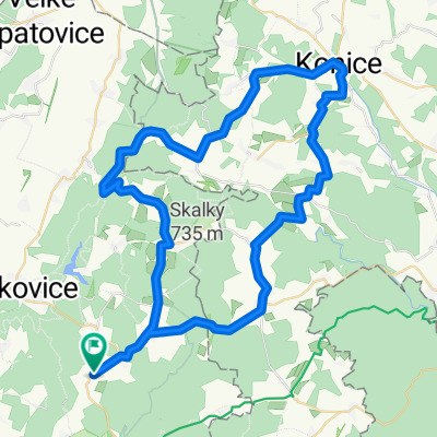
Point of interest after 3.3 km
horská prémie 4.kategorie
Point of interest after 32.8 km
vodní nádrž Křetínka
Point of interest after 37.6 km
horská prémie 3.kategorie
Point of interest after 44.3 km
horská prémie 4.kategorie
Point of interest after 60.6 km
horská prémie 3.kategorie (Sýkoř, 701 m n.m.)
Accommodation after 71.4 km
Hospoda, cukrárna
Point of interest after 76 km
horská prémie 3.kategorie
Point of interest after 98.9 km
horská prémie 2.kategorie
Continue with Bikemap
Use, edit, or download this cycling route
You would like to ride Němčice - Letovice - Sýkoř - Lomnice - Rájec - Němčice or customize it for your own trip? Here is what you can do with this Bikemap route:
Free features
- Save this route as favorite or in collections
- Copy & plan your own version of this route
- Split it into stages to create a multi-day tour
- Sync your route with Garmin or Wahoo
Premium features
Free trial for 3 days, or one-time payment. More about Bikemap Premium.
- Navigate this route on iOS & Android
- Export a GPX / KML file of this route
- Create your custom printout (try it for free)
- Download this route for offline navigation
Discover more Premium features.
Get Bikemap PremiumFrom our community
Other popular routes starting in Boskovice
 Boskovice - Usobrno - Protivanov - Blansko - Boskovice
- Distance
- 115.1 km
- Ascent
- 1,159 m
- Descent
- 1,159 m
- Location
- Boskovice, South Moravian, Czechia
 Němčice - Letovice - Sýkoř - Lomnice - Rájec - Němčice
- Distance
- 101 km
- Ascent
- 1,329 m
- Descent
- 1,329 m
- Location
- Boskovice, South Moravian, Czechia
 Němčice - Lipovec - Blansko - Němčice
- Distance
- 49.4 km
- Ascent
- 586 m
- Descent
- 586 m
- Location
- Boskovice, South Moravian, Czechia
 2025 Spätsommertour 08 Teil 1 A
- Distance
- 24.3 km
- Ascent
- 647 m
- Descent
- 603 m
- Location
- Boskovice, South Moravian, Czechia
 Němčice - Protivanov - Holubice - Benešov - Němčice
- Distance
- 47.3 km
- Ascent
- 559 m
- Descent
- 556 m
- Location
- Boskovice, South Moravian, Czechia
 Němčice - Žárovice - Protivanov - Benešov - Němčice
- Distance
- 60 km
- Ascent
- 819 m
- Descent
- 819 m
- Location
- Boskovice, South Moravian, Czechia
 Němčice - Protivanov - Plumlov - Studnice - Němčice
- Distance
- 65.3 km
- Ascent
- 722 m
- Descent
- 722 m
- Location
- Boskovice, South Moravian, Czechia
 Němčice - Protivanov - Konice - Kořenec - Němčice
- Distance
- 61.6 km
- Ascent
- 689 m
- Descent
- 689 m
- Location
- Boskovice, South Moravian, Czechia
Open it in the app