

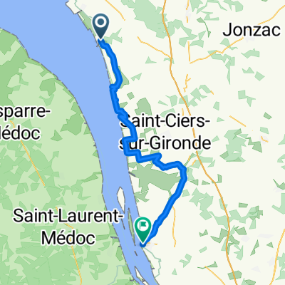
port maubert - blaye
A cycling route starting in Mortagne-sur-Gironde, Nouvelle-Aquitaine, France.
Overview
About this route
- 3 h 11 min
- Duration
- 54 km
- Distance
- 0 m
- Ascent
- 3 m
- Descent
- 17 km/h
- Avg. speed
- 4 m
- Max. altitude
Route quality
Waytypes & surfaces along the route
Waytypes
Quiet road
23.8 km
(44 %)
Cycleway
13 km
(24 %)
Surfaces
Paved
16.7 km
(31 %)
Asphalt
15.1 km
(28 %)
Paved (undefined)
1.6 km
(3 %)
Undefined
37.2 km
(69 %)
Route highlights
Points of interest along the route
Accommodation after 0 km
camping port maubert
Accommodation after 0 km
Continue with Bikemap
Use, edit, or download this cycling route
You would like to ride port maubert - blaye or customize it for your own trip? Here is what you can do with this Bikemap route:
Free features
- Save this route as favorite or in collections
- Copy & plan your own version of this route
- Sync your route with Garmin or Wahoo
Premium features
Free trial for 3 days, or one-time payment. More about Bikemap Premium.
- Navigate this route on iOS & Android
- Export a GPX / KML file of this route
- Create your custom printout (try it for free)
- Download this route for offline navigation
Discover more Premium features.
Get Bikemap PremiumFrom our community
Other popular routes starting in Mortagne-sur-Gironde
 port maubert - blaye
- Distance
- 54 km
- Ascent
- 0 m
- Descent
- 3 m
- Location
- Mortagne-sur-Gironde, Nouvelle-Aquitaine, France
 St Romain/Gironde - Royan
- Distance
- 42.5 km
- Ascent
- 170 m
- Descent
- 173 m
- Location
- Mortagne-sur-Gironde, Nouvelle-Aquitaine, France
 Montagne to Vitrezay
- Distance
- 24.8 km
- Ascent
- 30 m
- Descent
- 33 m
- Location
- Mortagne-sur-Gironde, Nouvelle-Aquitaine, France
 TDG Étape 11 : Seurin / Braud et Saint Louis
- Distance
- 42 km
- Ascent
- 15 m
- Descent
- 44 m
- Location
- Mortagne-sur-Gironde, Nouvelle-Aquitaine, France
 Frankreich 3
- Distance
- 50.2 km
- Ascent
- 374 m
- Descent
- 368 m
- Location
- Mortagne-sur-Gironde, Nouvelle-Aquitaine, France
 20180824 - Mortagne-Reignac
- Distance
- 59.5 km
- Ascent
- 79 m
- Descent
- 54 m
- Location
- Mortagne-sur-Gironde, Nouvelle-Aquitaine, France
 18 Mortagne sur Gironde to Blaye
- Distance
- 57.5 km
- Ascent
- 0 m
- Descent
- 0 m
- Location
- Mortagne-sur-Gironde, Nouvelle-Aquitaine, France
 Boutenac - St Romain
- Distance
- 9.1 km
- Ascent
- 115 m
- Descent
- 149 m
- Location
- Mortagne-sur-Gironde, Nouvelle-Aquitaine, France
Open it in the app