

Himmelfahrtstour 2024
A cycling route starting in Naila, Bavaria, Germany.
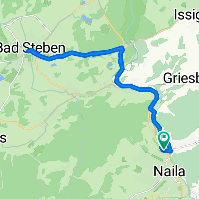
Overview
About this route
- -:--
- Duration
- 198.7 km
- Distance
- 2,765 m
- Ascent
- 2,749 m
- Descent
- ---
- Avg. speed
- 807 m
- Max. altitude

Route quality
Waytypes & surfaces along the route
Waytypes
Quiet road
63.1 km
(32 %)
Track
40.3 km
(20 %)
Surfaces
Paved
113.3 km
(57 %)
Unpaved
34.6 km
(17 %)
Asphalt
96 km
(48 %)
Gravel
25.9 km
(13 %)
Continue with Bikemap
Use, edit, or download this cycling route
You would like to ride Himmelfahrtstour 2024 or customize it for your own trip? Here is what you can do with this Bikemap route:
Free features
- Save this route as favorite or in collections
- Copy & plan your own version of this route
- Split it into stages to create a multi-day tour
- Sync your route with Garmin or Wahoo
Premium features
Free trial for 3 days, or one-time payment. More about Bikemap Premium.
- Navigate this route on iOS & Android
- Export a GPX / KML file of this route
- Create your custom printout (try it for free)
- Download this route for offline navigation
Discover more Premium features.
Get Bikemap PremiumFrom our community
Other popular routes starting in Naila
 Am Hammerberg 6, Naila nach Am Hammerberg 4, Naila
- Distance
- 17.3 km
- Ascent
- 191 m
- Descent
- 190 m
- Location
- Naila, Bavaria, Germany
 DÖ91-Vochelaweg ab Naila
- Distance
- 33.1 km
- Ascent
- 557 m
- Descent
- 566 m
- Location
- Naila, Bavaria, Germany
 Naila - Weiden OPF
- Distance
- 111.5 km
- Ascent
- 506 m
- Descent
- 615 m
- Location
- Naila, Bavaria, Germany
 Fasanenweg 5, Naila nach Fasanenweg 5, Naila
- Distance
- 50 km
- Ascent
- 687 m
- Descent
- 634 m
- Location
- Naila, Bavaria, Germany
 Von Naila bis Wallenfels
- Distance
- 20.9 km
- Ascent
- 441 m
- Descent
- 389 m
- Location
- Naila, Bavaria, Germany
 Himmelfahrtstour 2024
- Distance
- 198.7 km
- Ascent
- 2,765 m
- Descent
- 2,749 m
- Location
- Naila, Bavaria, Germany
 Route Bad Steben Piazetta in Naila
- Distance
- 18.9 km
- Ascent
- 474 m
- Descent
- 472 m
- Location
- Naila, Bavaria, Germany
 kleine Feierabendroute in (Froschbachtal)Naila
- Distance
- 12.9 km
- Ascent
- 229 m
- Descent
- 223 m
- Location
- Naila, Bavaria, Germany
Open it in the app