

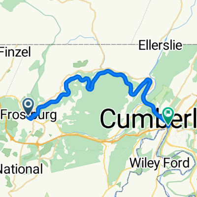
Big Savage Tunnel Detour
A cycling route starting in Frostburg, Maryland, United States of America.
Overview
About this route
- -:--
- Duration
- 15.2 km
- Distance
- 438 m
- Ascent
- 588 m
- Descent
- ---
- Avg. speed
- 852 m
- Max. altitude

Route quality
Waytypes & surfaces along the route
Waytypes
Busy road
8.7 km
(57 %)
Road
3.8 km
(25 %)
Surfaces
Paved
4.4 km
(29 %)
Asphalt
4.4 km
(29 %)
Undefined
10.8 km
(71 %)
Continue with Bikemap
Use, edit, or download this cycling route
You would like to ride Big Savage Tunnel Detour or customize it for your own trip? Here is what you can do with this Bikemap route:
Free features
- Save this route as favorite or in collections
- Copy & plan your own version of this route
- Sync your route with Garmin or Wahoo
Premium features
Free trial for 3 days, or one-time payment. More about Bikemap Premium.
- Navigate this route on iOS & Android
- Export a GPX / KML file of this route
- Create your custom printout (try it for free)
- Download this route for offline navigation
Discover more Premium features.
Get Bikemap PremiumFrom our community
Other popular routes starting in Frostburg
 Moderate route in Cumberland
- Distance
- 26.5 km
- Ascent
- 140 m
- Descent
- 584 m
- Location
- Frostburg, Maryland, United States of America
 Moderate route to Frostburg
- Distance
- 14.2 km
- Ascent
- 411 m
- Descent
- 484 m
- Location
- Frostburg, Maryland, United States of America
 My rout
- Distance
- 16.5 km
- Ascent
- 436 m
- Descent
- 436 m
- Location
- Frostburg, Maryland, United States of America
 First St, Frostburg to 13 Canal St, Cumberland
- Distance
- 26.6 km
- Ascent
- 322 m
- Descent
- 750 m
- Location
- Frostburg, Maryland, United States of America
 Mount Savage to 21 N Wineow St, Cumberland
- Distance
- 19.7 km
- Ascent
- 62 m
- Descent
- 290 m
- Location
- Frostburg, Maryland, United States of America
 Great Allegheny Passage, Meyersdale to 83rd Place 6410, Cabin John
- Distance
- 250.6 km
- Ascent
- 4,716 m
- Descent
- 5,420 m
- Location
- Frostburg, Maryland, United States of America
 Armstrong Avenue 272, Frostburg to Canal Parkway 13, Cumberland
- Distance
- 18.4 km
- Ascent
- 194 m
- Descent
- 673 m
- Location
- Frostburg, Maryland, United States of America
 Recovered Route
- Distance
- 200.6 km
- Ascent
- 871 m
- Descent
- 764 m
- Location
- Frostburg, Maryland, United States of America
Open it in the app