

FA02 Saint-Point-Lac
A cycling route starting in Blamont, Bourgogne-Franche-Comté, France.
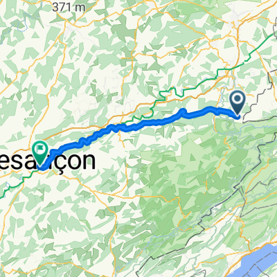
Overview
About this route
Bike trekking Jura and French Alpes Basel-Barcelonette-Lyon
- -:--
- Duration
- 98.7 km
- Distance
- 929 m
- Ascent
- 493 m
- Descent
- ---
- Avg. speed
- ---
- Max. altitude
Route quality
Waytypes & surfaces along the route
Waytypes
Road
8.9 km
(9 %)
Quiet road
5.9 km
(6 %)
Surfaces
Paved
69.1 km
(70 %)
Unpaved
1 km
(1 %)
Asphalt
69.1 km
(70 %)
Unpaved (undefined)
1 km
(1 %)
Undefined
28.6 km
(29 %)
Route highlights
Points of interest along the route
Point of interest after 87 km
Pontarlier - Camping Le Larmont
Point of interest after 98.7 km
Saint-Point-Lac Camp Municipal Telefon: +33 (0)381696164
Continue with Bikemap
Use, edit, or download this cycling route
You would like to ride FA02 Saint-Point-Lac or customize it for your own trip? Here is what you can do with this Bikemap route:
Free features
- Save this route as favorite or in collections
- Copy & plan your own version of this route
- Split it into stages to create a multi-day tour
- Sync your route with Garmin or Wahoo
Premium features
Free trial for 3 days, or one-time payment. More about Bikemap Premium.
- Navigate this route on iOS & Android
- Export a GPX / KML file of this route
- Create your custom printout (try it for free)
- Download this route for offline navigation
Discover more Premium features.
Get Bikemap PremiumFrom our community
Other popular routes starting in Blamont
 projet 261 #25
- Distance
- 15 km
- Ascent
- 180 m
- Descent
- 165 m
- Location
- Blamont, Bourgogne-Franche-Comté, France
 Blamont - Besançon
- Distance
- 80.7 km
- Ascent
- 887 m
- Descent
- 1,230 m
- Location
- Blamont, Bourgogne-Franche-Comté, France
 Pierrefontaine-Mon Cheroux
- Distance
- 3.9 km
- Ascent
- 29 m
- Descent
- 267 m
- Location
- Blamont, Bourgogne-Franche-Comté, France
 7. Etappe - Vaufrey - Genf
- Distance
- 213.8 km
- Ascent
- 1,758 m
- Descent
- 1,737 m
- Location
- Blamont, Bourgogne-Franche-Comté, France
 Westalpen_4
- Distance
- 70.1 km
- Ascent
- 697 m
- Descent
- 362 m
- Location
- Blamont, Bourgogne-Franche-Comté, France
 Cycling the Alps Cote du Passage de la Douleur (0806m)
- Distance
- 3.8 km
- Ascent
- 274 m
- Descent
- 30 m
- Location
- Blamont, Bourgogne-Franche-Comté, France
 SuperRide3
- Distance
- 58.2 km
- Ascent
- 428 m
- Descent
- 659 m
- Location
- Blamont, Bourgogne-Franche-Comté, France
 Rue de Courclavon, Glère nach 14 Rue de l'Orme de Chamars, Besançon
- Distance
- 99.9 km
- Ascent
- 1,144 m
- Descent
- 1,355 m
- Location
- Blamont, Bourgogne-Franche-Comté, France
Open it in the app