
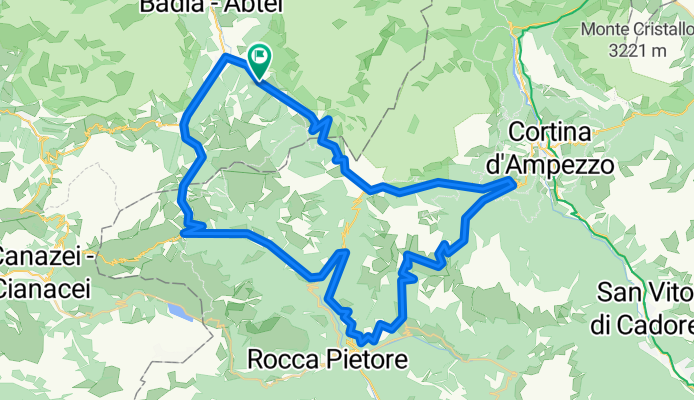
RR-Berg: St.Cassiano-Corvara-PassoCampolongo-Arabba-Livinallongo-Andraz-Rucava-Pian-PassoGiau-Pocol-PassoFalzarego-PassoValparola-St.Cassiano
A cycling route starting in Abtei-Badia, Trentino-Alto Adige, Italy.
Overview
About this route
RR-Berg: St. Cassiano - Corvara - Passo Campolongo - Arabba - Livinallongo - Andraz - Rucava - Pian - Passo Giau Pocol - Passo Falzarego - Passo Valparola - St. Cassiano
- -:--
- Duration
- 83.7 km
- Distance
- 2,909 m
- Ascent
- 2,905 m
- Descent
- ---
- Avg. speed
- 2,234 m
- Avg. speed

Route quality
Waytypes & surfaces along the route
Waytypes
Busy road
80.2 km
(96 %)
Quiet road
1.1 km
(1 %)
Surfaces
Paved
80.4 km
(96 %)
Unpaved
0.6 km
(<1 %)
Asphalt
80.4 km
(96 %)
Gravel
0.3 km
(<1 %)
Continue with Bikemap
Use, edit, or download this cycling route
You would like to ride RR-Berg: St.Cassiano-Corvara-PassoCampolongo-Arabba-Livinallongo-Andraz-Rucava-Pian-PassoGiau-Pocol-PassoFalzarego-PassoValparola-St.Cassiano or customize it for your own trip? Here is what you can do with this Bikemap route:
Free features
- Save this route as favorite or in collections
- Copy & plan your own version of this route
- Sync your route with Garmin or Wahoo
Premium features
Free trial for 3 days, or one-time payment. More about Bikemap Premium.
- Navigate this route on iOS & Android
- Export a GPX / KML file of this route
- Create your custom printout (try it for free)
- Download this route for offline navigation
Discover more Premium features.
Get Bikemap PremiumFrom our community
Other popular routes starting in Abtei-Badia
 Maratona dles Dolomites
- Distance
- 138 km
- Ascent
- 5,099 m
- Descent
- 4,822 m
- Location
- Abtei-Badia, Trentino-Alto Adige, Italy
 La Villa - Pian dell'Armentara
- Distance
- 20.6 km
- Ascent
- 862 m
- Descent
- 860 m
- Location
- Abtei-Badia, Trentino-Alto Adige, Italy
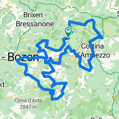 Dolomites +
- Distance
- 380.4 km
- Ascent
- 11,658 m
- Descent
- 11,668 m
- Location
- Abtei-Badia, Trentino-Alto Adige, Italy
 Campolongo_Pellegrino_Valles_2015_2
- Distance
- 104.3 km
- Ascent
- 2,326 m
- Descent
- 2,684 m
- Location
- Abtei-Badia, Trentino-Alto Adige, Italy
 St. Kassian-Armentarola-Störes-Corvara-St. Kassian
- Distance
- 23.2 km
- Ascent
- 822 m
- Descent
- 827 m
- Location
- Abtei-Badia, Trentino-Alto Adige, Italy
 Kirche San Leonardo - Kirche Heilig Kreuz
- Distance
- 15.8 km
- Ascent
- 933 m
- Descent
- 933 m
- Location
- Abtei-Badia, Trentino-Alto Adige, Italy
 Rifugio Genova dal Passo Delle Erbe
- Distance
- 12.9 km
- Ascent
- 560 m
- Descent
- 560 m
- Location
- Abtei-Badia, Trentino-Alto Adige, Italy
 Dolomitok 2. nap (multi)
- Distance
- 160.1 km
- Ascent
- 3,537 m
- Descent
- 3,534 m
- Location
- Abtei-Badia, Trentino-Alto Adige, Italy
Open it in the app