

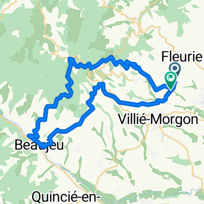
Ouroux
A cycling route starting in Fleurie, Auvergne-Rhône-Alpes, France.
Overview
About this route
- -:--
- Duration
- 33.4 km
- Distance
- 808 m
- Ascent
- 807 m
- Descent
- ---
- Avg. speed
- 681 m
- Max. altitude

Route quality
Waytypes & surfaces along the route
Waytypes
Quiet road
6.7 km
(20 %)
Road
2.7 km
(8 %)
Surfaces
Paved
10 km
(30 %)
Unpaved
1.3 km
(4 %)
Asphalt
10 km
(30 %)
Unpaved (undefined)
1 km
(3 %)
Continue with Bikemap
Use, edit, or download this cycling route
You would like to ride Ouroux or customize it for your own trip? Here is what you can do with this Bikemap route:
Free features
- Save this route as favorite or in collections
- Copy & plan your own version of this route
- Sync your route with Garmin or Wahoo
Premium features
Free trial for 3 days, or one-time payment. More about Bikemap Premium.
- Navigate this route on iOS & Android
- Export a GPX / KML file of this route
- Create your custom printout (try it for free)
- Download this route for offline navigation
Discover more Premium features.
Get Bikemap PremiumFrom our community
Other popular routes starting in Fleurie
 52 km Pruzilly - Pierreclos -Fuissé
- Distance
- 51.9 km
- Ascent
- 879 m
- Descent
- 871 m
- Location
- Fleurie, Auvergne-Rhône-Alpes, France
 48 km Bourgongne - Beaujolais
- Distance
- 47.7 km
- Ascent
- 693 m
- Descent
- 696 m
- Location
- Fleurie, Auvergne-Rhône-Alpes, France
 Tramayes via Cenves, return via Germolles
- Distance
- 36.6 km
- Ascent
- 1,279 m
- Descent
- 1,287 m
- Location
- Fleurie, Auvergne-Rhône-Alpes, France
 Rondje Fleurie
- Distance
- 43 km
- Ascent
- 411 m
- Descent
- 411 m
- Location
- Fleurie, Auvergne-Rhône-Alpes, France
 Cenves, Saint-Jacques-Des-Arrets, then Ouroux to Avenas and back via Chiroubles
- Distance
- 42.3 km
- Ascent
- 1,265 m
- Descent
- 1,300 m
- Location
- Fleurie, Auvergne-Rhône-Alpes, France
 De Juliénas à Juliénas
- Distance
- 33.7 km
- Ascent
- 872 m
- Descent
- 872 m
- Location
- Fleurie, Auvergne-Rhône-Alpes, France
 Des Bois
- Distance
- 28.8 km
- Ascent
- 704 m
- Descent
- 692 m
- Location
- Fleurie, Auvergne-Rhône-Alpes, France
 41 km Côte Maconnaise
- Distance
- 41.4 km
- Ascent
- 853 m
- Descent
- 852 m
- Location
- Fleurie, Auvergne-Rhône-Alpes, France
Open it in the app