

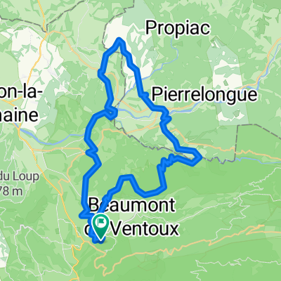
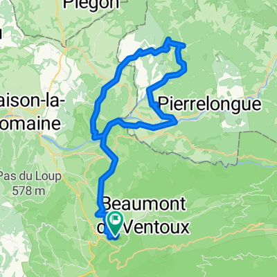
Malaucene-MontVentaux
A cycling route starting in Malaucène, Provence-Alpes-Côte d'Azur Region, France.
Overview
About this route
Nordrampe zum grossen Riesen
- -:--
- Duration
- 21.2 km
- Distance
- 1,597 m
- Ascent
- 26 m
- Descent
- ---
- Avg. speed
- 1,899 m
- Max. altitude

Route quality
Waytypes & surfaces along the route
Waytypes
Pedestrian area
0.2 km
(1 %)
Undefined
21 km
(99 %)
Surfaces
Paved
21.2 km
(100 %)
Asphalt
21 km
(99 %)
Concrete
0.2 km
(1 %)
Continue with Bikemap
Use, edit, or download this cycling route
You would like to ride Malaucene-MontVentaux or customize it for your own trip? Here is what you can do with this Bikemap route:
Free features
- Save this route as favorite or in collections
- Copy & plan your own version of this route
- Sync your route with Garmin or Wahoo
Premium features
Free trial for 3 days, or one-time payment. More about Bikemap Premium.
- Navigate this route on iOS & Android
- Export a GPX / KML file of this route
- Create your custom printout (try it for free)
- Download this route for offline navigation
Discover more Premium features.
Get Bikemap PremiumFrom our community
Other popular routes starting in Malaucène
 route suzette
- Distance
- 39.5 km
- Ascent
- 725 m
- Descent
- 725 m
- Location
- Malaucène, Provence-Alpes-Côte d'Azur Region, France
 petite boucle 2
- Distance
- 41.3 km
- Ascent
- 1,163 m
- Descent
- 1,163 m
- Location
- Malaucène, Provence-Alpes-Côte d'Azur Region, France
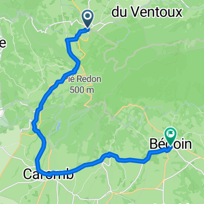 Rue du Capitaine Jallier, Malaucène nach Rue des Calignaires, Bédoin
- Distance
- 16.9 km
- Ascent
- 356 m
- Descent
- 380 m
- Location
- Malaucène, Provence-Alpes-Côte d'Azur Region, France
 petit tour qui monte
- Distance
- 39.3 km
- Ascent
- 1,090 m
- Descent
- 1,090 m
- Location
- Malaucène, Provence-Alpes-Côte d'Azur Region, France
 FRA E4.3 - 150km 4400hm
- Distance
- 135.9 km
- Ascent
- 4,358 m
- Descent
- 4,353 m
- Location
- Malaucène, Provence-Alpes-Côte d'Azur Region, France
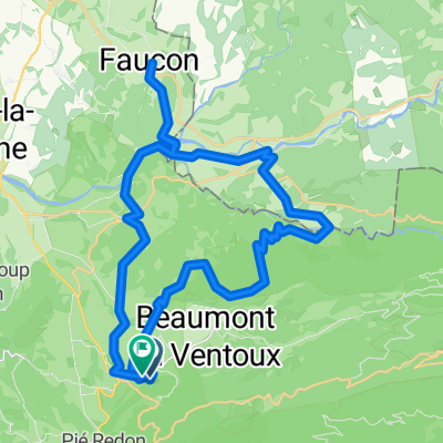
 Chemin de Brassetieu, Malaucène à Chemin de Brassetieu, Malaucène
- Distance
- 43.3 km
- Ascent
- 1,092 m
- Descent
- 1,091 m
- Location
- Malaucène, Provence-Alpes-Côte d'Azur Region, France
 Malaucene - Ventoux 22KM 1800 HM
- Distance
- 21.8 km
- Ascent
- 1,800 m
- Descent
- 253 m
- Location
- Malaucène, Provence-Alpes-Côte d'Azur Region, France
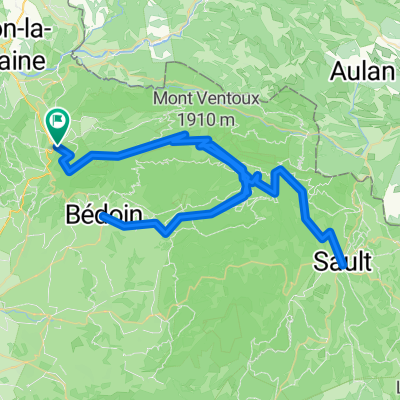
 Baronnien und Touleranceschlucht
- Distance
- 121.4 km
- Ascent
- 1,454 m
- Descent
- 1,454 m
- Location
- Malaucène, Provence-Alpes-Côte d'Azur Region, France
Open it in the app