

Dookoła Polski 12 dzień ( Suchodół-Słubice)
A cycling route starting in Brody, Lubusz Voivodship, Poland.
Overview
About this route
Day 12 Friday 15.07.2011
Distance 147.2 km Time 7 hours 10 minutes Average speed 20.49 km/h Max speed 40.4 km/h
After the morning adventure, I set off again towards the Polish-German border. The cycling routes on the German side of the Neisse and then the Oder rivers are so fantastic that I decide to spend most of the time there. Despite good signage, I managed to get lost a few times and add extra kilometers.
Only returning to the homeland for shopping and overnight stay. The day is cool, windy and cloudy but without rain. There are no more mountains or views but it is still interesting. Lots of cyclists with panniers and without, and inline skaters. Everyone greets each other with the German ‘Hallo’. I will have to come back here sometime.
A bit boring and monotonous, I have little to write, but after the mountain adventures, I can’t complain. I also found overnight accommodation on the German side near Frankfurt on the map. A few more kilometers to look for a spot. Maybe the night will pass without any additional incidents.
- -:--
- Duration
- 96.6 km
- Distance
- 158 m
- Ascent
- 196 m
- Descent
- ---
- Avg. speed
- ---
- Max. altitude

Route highlights
Points of interest along the route
\"")
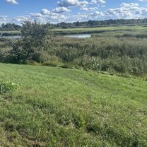
Point of interest after 36.4 km
Niemiecka "ścieżka rowerowa"- toż to autostrada
Continue with Bikemap
Use, edit, or download this cycling route
You would like to ride Dookoła Polski 12 dzień ( Suchodół-Słubice) or customize it for your own trip? Here is what you can do with this Bikemap route:
Free features
- Save this route as favorite or in collections
- Copy & plan your own version of this route
- Split it into stages to create a multi-day tour
- Sync your route with Garmin or Wahoo
Premium features
Free trial for 3 days, or one-time payment. More about Bikemap Premium.
- Navigate this route on iOS & Android
- Export a GPX / KML file of this route
- Create your custom printout (try it for free)
- Download this route for offline navigation
Discover more Premium features.
Get Bikemap PremiumFrom our community
Other popular routes starting in Brody
 2012-10-18 Forst-Eisenhüttenstadt
- Distance
- 130.6 km
- Ascent
- 100 m
- Descent
- 101 m
- Location
- Brody, Lubusz Voivodship, Poland
 Skater Strecke Forst / Lausitz-Briesnig und zurück zum Startpunkt
- Distance
- 22.7 km
- Ascent
- 32 m
- Descent
- 33 m
- Location
- Brody, Lubusz Voivodship, Poland
 Skater-Strecke Forst Guben Tagestour hin und zurück
- Distance
- 33.4 km
- Ascent
- 81 m
- Descent
- 116 m
- Location
- Brody, Lubusz Voivodship, Poland
 Forst - Leszno
- Distance
- 164.2 km
- Ascent
- 178 m
- Descent
- 166 m
- Location
- Brody, Lubusz Voivodship, Poland
 pl Zamkowy, Brody do Orła Białego, Kostrzyn nad Odrą
- Distance
- 141.3 km
- Ascent
- 305 m
- Descent
- 348 m
- Location
- Brody, Lubusz Voivodship, Poland
 Oder-Neiße Part 2
- Distance
- 77.5 km
- Ascent
- 80 m
- Descent
- 129 m
- Location
- Brody, Lubusz Voivodship, Poland
 Forst - Stettiner Haff - Berlin
- Distance
- 534.2 km
- Ascent
- 250 m
- Descent
- 297 m
- Location
- Brody, Lubusz Voivodship, Poland
 Forst, Rosengarten, Forst (Lausitz) nach Hainstraße 6, Cottbus
- Distance
- 31 km
- Ascent
- 112 m
- Descent
- 115 m
- Location
- Brody, Lubusz Voivodship, Poland
Open it in the app