Trasa Pojezierzy Zachodnich
- 339.9 km
- 1,351 m
- 1,222 m
- Cedynia, West Pomeranian Voivodeship, Poland
A cycling route starting in Cedynia, West Pomeranian Voivodeship, Poland.
Overview
Day 14 Sunday 17.07.2011
Distance 176.9 km (punishing myself on a Sunday!) Time 9.28 hours Average speed 18.7 km/h Max speed 48.0 km/h
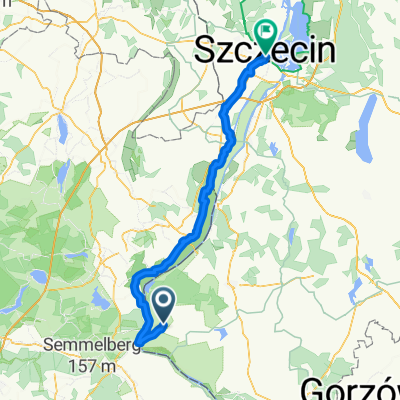
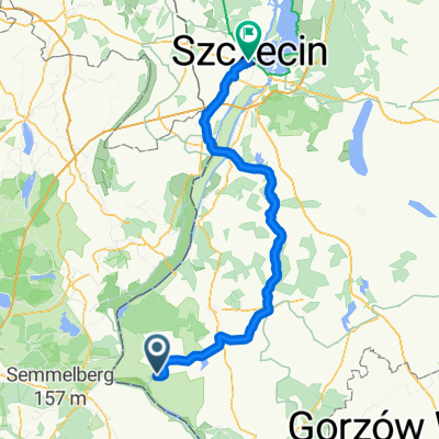
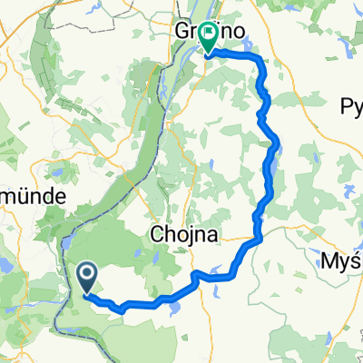
"No change in the west" in Krajnik I returned, as it later turned out, for the last time to the western neighbors. During one of the breaks I hear Polish. I start a conversation, Małgosia and Irek advise me on which way to go. Initially I planned to circle the Szczecin Lagoon but gave up. I return to Poland at Kołbaskowo. Then I enter Szczecin and along the eastern shore of Lake Dąbie and then the lagoon head towards Wolin. Traffic on the main route to Goleniów is very heavy. While looking for local roads I got a bit lost, traveled on concrete slabs and even field roads. When I got back on the main route it turned out that the side roads were also crowded. These are cars of people returning from the sea, circumventing the traffic jams forming on the Świnoujście-Szczecin road. The lagoon shore where I wanted to stay overnight was overgrown with bushes. As usual, I ask someone for a place to pitch the tent. Another "strange" place, an islet on the Dziwna river near the Viking stronghold. I planned to go further, but "maybe tomorrow there will be the sea" or rather, certainly will be. Even day, cloudy and warm. At night it rained heavily, but it no longer made any impression on me.
created this 13 years ago
Route quality
Road
28.8 km
(17 %)
Track
25.4 km
(15 %)
Paved
135.6 km
(80 %)
Unpaved
13.6 km
(8 %)
Asphalt
125.5 km
(74 %)
Concrete
8.5 km
(5 %)
Route highlights
\"")
Most w okol. Gryfina
\"")
Szczecin
Continue with Bikemap
You would like to ride Dookoła Polski 14 dzień ( Orzechów-Wolin) or customize it for your own trip? Here is what you can do with this Bikemap route:
Free trial for 3 days, or one-time payment. More about Bikemap Premium.
Discover more Premium features.
Get Bikemap PremiumFrom our community
Open it in the app